Park Visit: August 23 - 25, 2017
Summit Date Of Park Highpoint: August 24, 2017
A SLIGHT CHANGE OF PLANS
This post should’ve been about Kings Peak, the highpoint of Utah, but sometimes travel plans go out the window and you have to improvise. A few days prior, I had the incredible fortune to see The Great American Eclipse of 2017 from the summit of Borah Peak, the highpoint of Idaho. It was a spectacular day, which you can read about in my other post here. That hike took more out of me than I was expecting and the next day I was feeling it. I had some sore spots on my toes, and while they never blistered they were still a little tender from the hotspots I developed on the way down. The day after Borah was supposed to be my travel day to get to Kings Peak, but between my physical condition and the forecast for the Kings Peak area I finally opted to not do it. With a roundtrip distance of 28 miles and 5,300 feet of elevation gain, Kings peak has the third longest approach hike out of the 50 highpoints, behind only Wyoming's Gannett Peak and Denali in Alaska, and seventh highest amount of gain. So if you're not 100% confident about the situation, it might be wise to rethink it. Which is where I found myself.
I really hadn't made a back up plan, but alternate adventures aren't hard to find in this part of the world. I immediately started thinking about the national parks in southern Utah: Zion, Bryce Canyon, Canyonlands, Arches, and Capitol Reef. Stupidly I forgot to bring my national park guide book (what self respecting travel nerd doesn't carry one at all times?). So I stopped by the Barnes & Noble in Salt Lake City to look up what I needed. As I was flipping through the pages I looked at one of the maps and there it was: Great Basin National Park. It's always been one of those parks that seemed so out of the way that I'd never get to it. But it really wasn't THAT far out of the way. I figured this was the perfect opportunity to visit it. My destination was set! I would visit GBNP for a couple of nights and then drive over to Bryce Canyon National Park. Both parks were a reasonably close drive to Route 15, which leads north to Salt Lake City, where I was flying out of at the end of the week.

Route 50. The loneliest road in America. Heading toward Great Basin NP.
On my drive to the park I got off of US Route 15, and after a bit, onto Route 50. As darkness fell I passed the towns of Delta and Hinckley, then saw a sign that read "Next Services 90 Miles". This was some desolate country. I started to get drowsy so I pulled over into a dirt pull-out to sleep for the night. I stepped out of the car to stretch. When I looked up at the sky my jaw just dropped. It was one of the most amazing night skies I'd ever seen. The band of the Milky Way was clearly visible and the sky was full of stars. It was stunningly breath-taking. I definitely needed to do some night photography in the park. The campground I was hoping to get into was at 10,000 feet, so I knew the night sky would be even more spectacular. Just had to cross my fingers they had some open spots.
DAY ONE: ARRIVAL, LEHMAN CAVE TOUR, AND THAT NIGHT SKY
The next morning I hit the road to finish the last hour or two to the park. Route 50 through Nevada is often called the loneliest road in America. I was still in Utah and it was already feeling pretty lonely. There was nothing but nothing. No towns, no houses, the occasional dirt road heading off to parts unknown. I rarely even saw another car. Eventually I got to the state border, where there was a gas station/casino. The gas station was on the Utah side, the casino was on the Nevada side, because of course it was. From here it was just a short 15 minutes to the park's visitor center.
I stopped in at the visitor center to check on campsites at Wheeler Peak campground. It's a first come/first served site, so I wouldn't know until I actually got up there. While at the visitor center I learned of a ranger led tour through Lehman Caves, one of the park’s main attractions, later in the afternoon. The entrance was right behind the visitor center. As luck would have it I got the last spot on the tour. I had some time before that started so I headed up the mountain to see if my luck would hold out again and I could get a campsite.
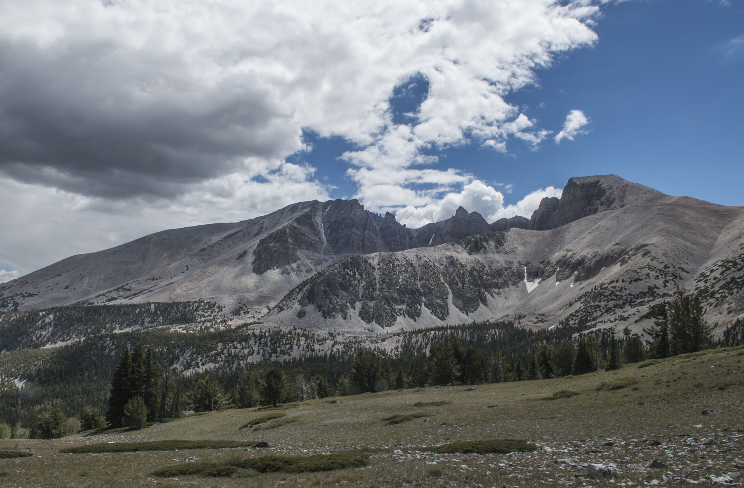
As I drove up the mountain it was easy to see why this was a national park. It was an oasis in the middle of the desert. It reminded me of an island, except instead of being surrounded by water, Great Basin was surrounded by the arid desert floor. The park was very lush and green, especially as I ascended from the visitor center. The road to Wheeler Peak campground rises 3,000 feet from the visitor center. The views from the road were amazing. Being close to the state line I could see the mountains over in Utah. I didn't stop at any of the pull outs because I was anxious to claim a spot in the campground. I'd have plenty of time for stopping later.

View from my campsite at Wheeler peak campground. Jeff Davis Peak is on the left and Wheeler Peak is on the right behind the tree.
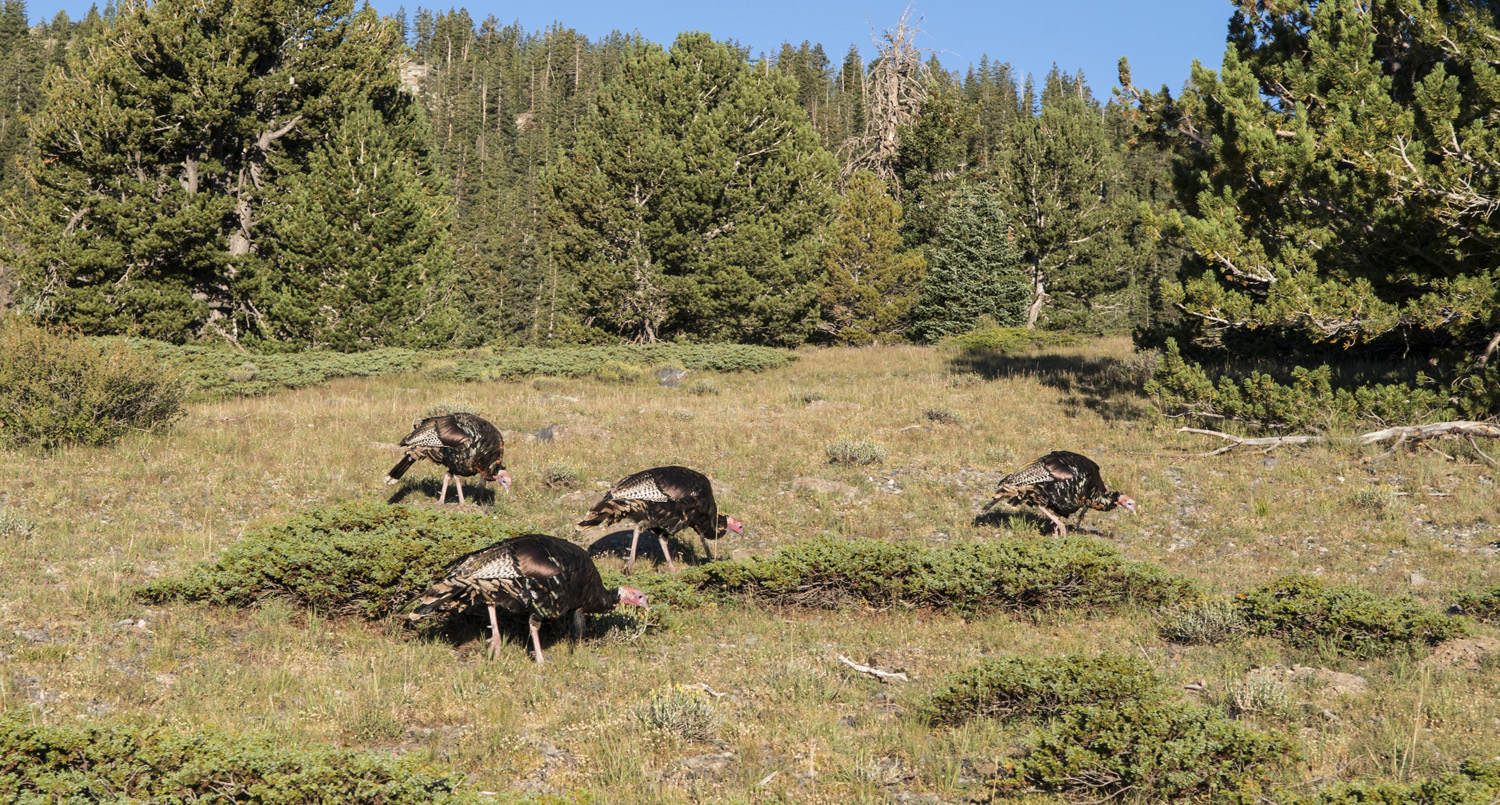
I arrived at Wheeler Peak campground and started looking for a spot. Despite being the middle of the week (Wednesday), the grounds were almost full. Almost. On the farthest loop in the back of the grounds there was a spot. Not only was it in a low traffic area with a neighbor on only one side, but it had one of the best views in the whole campground. Oh lucky day! I went to the check in and paid for two nights. Now I could relax and enjoy the park. On my walk back to my site I passed a flock of wild turkeys roaming around the grounds.
As I started setting up camp, I got talking to my neighbors, a lovely young couple who were just packing up to head out. They were traveling around the Southwest checking off national parks. I shared my story of seeing the eclipse a few days before and showed them a few pics from it. I told them all about highpointing and they seemed really interested in that. More converts to this crazy hobby!
After I got settled in I cooked up some breakfast (dehydrated eggs and tea) while taking in the view of Jeff Davis and Wheeler Peaks and planning out my time in the park. The weather was quite pleasant. Despite being August in Nevada, it was actually on the cool side since the campground was just shy of 10,000 feet. And there was a crispness to the air that you only find when visiting wild places like this. It feels like you can breathe a little deeper.
With the cave tour coming up I started making my way back down the mountain. This time I stopped at some of the pullouts and overlooks. There were some breathtaking views, both out toward the desert and back up toward the mountain. The island metaphor kept coming back to me. From so high up I could see the miles and miles of beige desert below, while all around me was vivid green forests. With such an elevation change I actually went through several environmental zones. As I got farther down the mountain, the trees became a little smaller and more sparse.
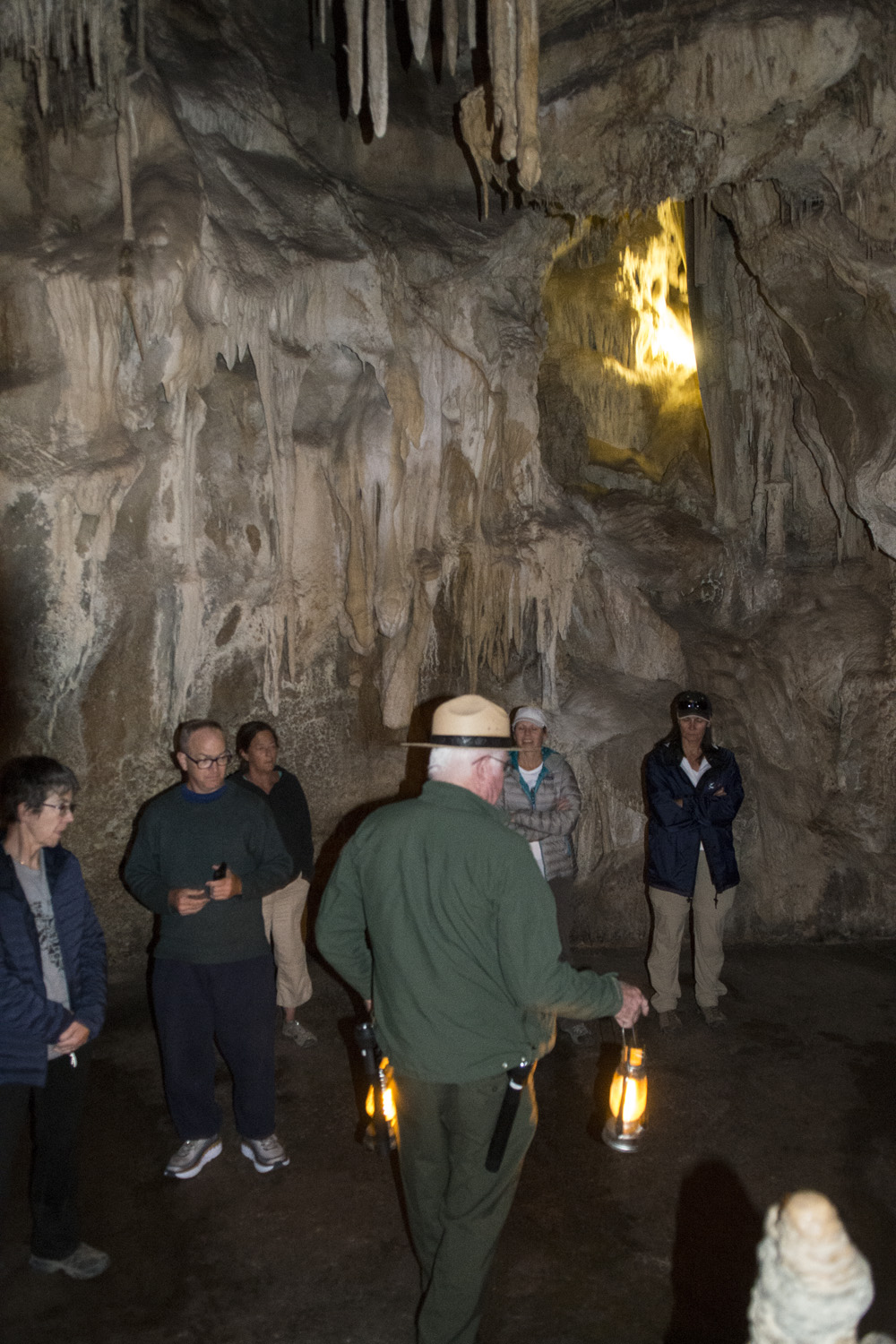
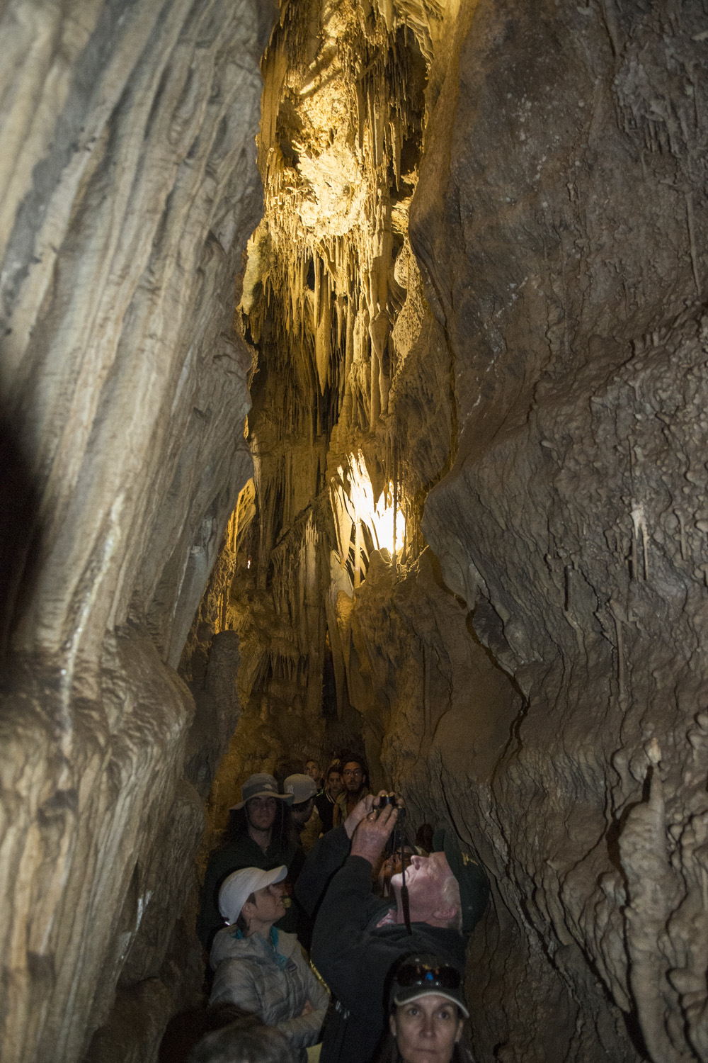
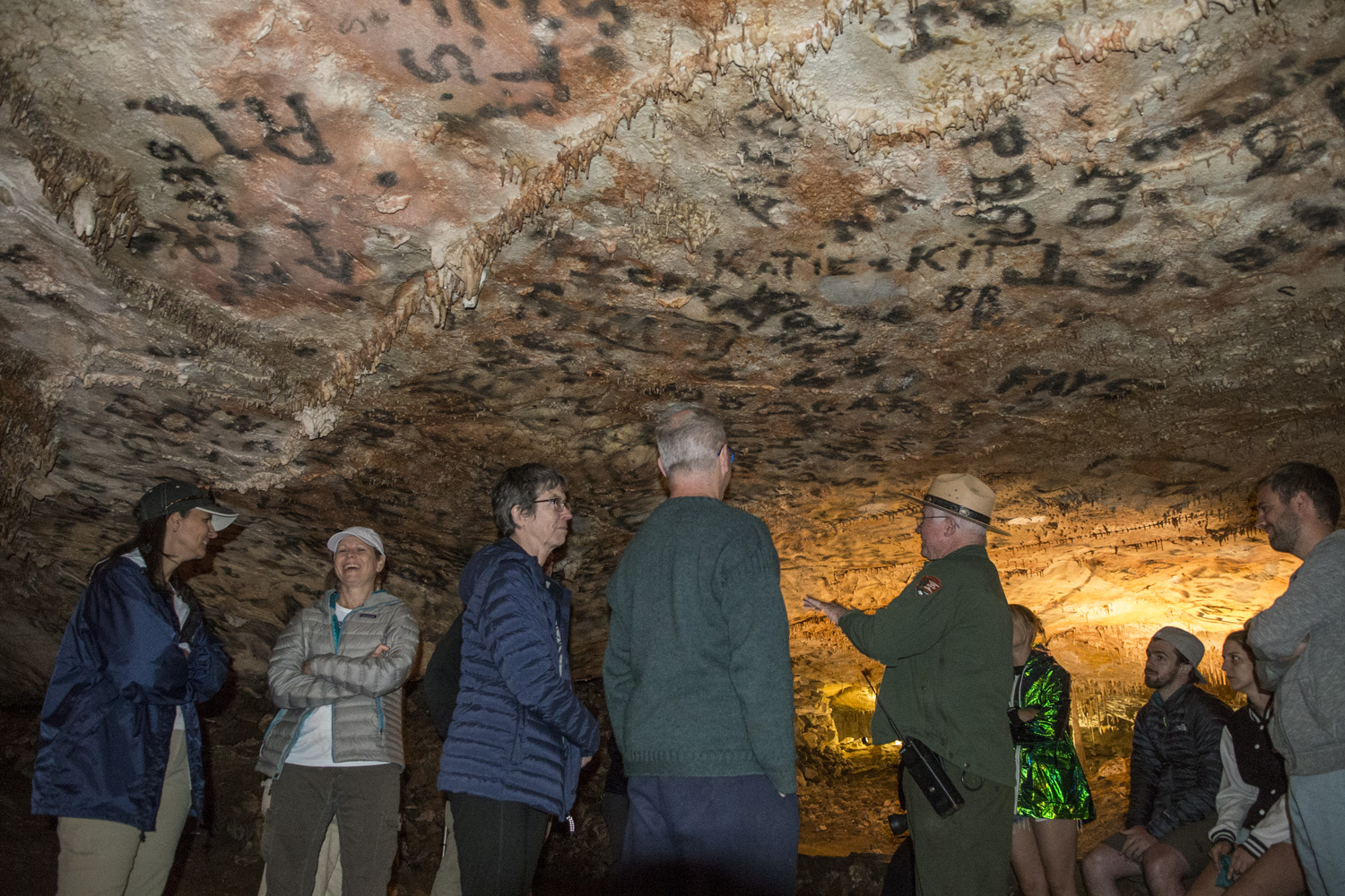
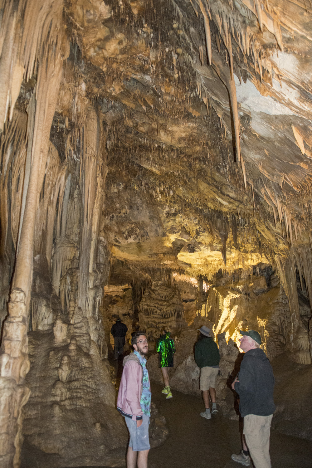
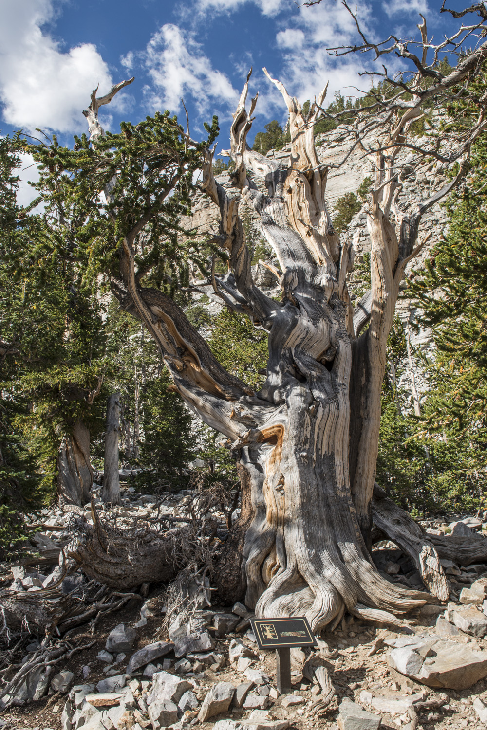
I still had a little time left before the tour so I checked out the interesting interpretive nature trail behind the visitor center. It's only about a quarter mile long and shows off some of the plant life in the more arid lower elevations of the park along with some historical relics. The entrance to the caves was directly behind the visitor center, behind a locked door. They only allow ranger led tours, as they need to keep out the riff raff. There was about 20 of us, and our ranger was a kindly older fella who had worked for the NPS and at Great Basin for years.
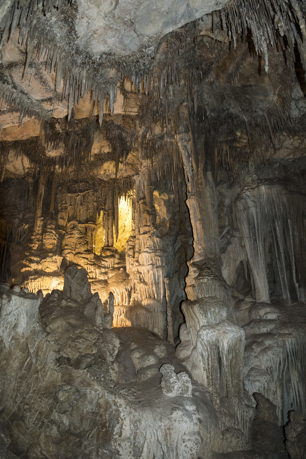
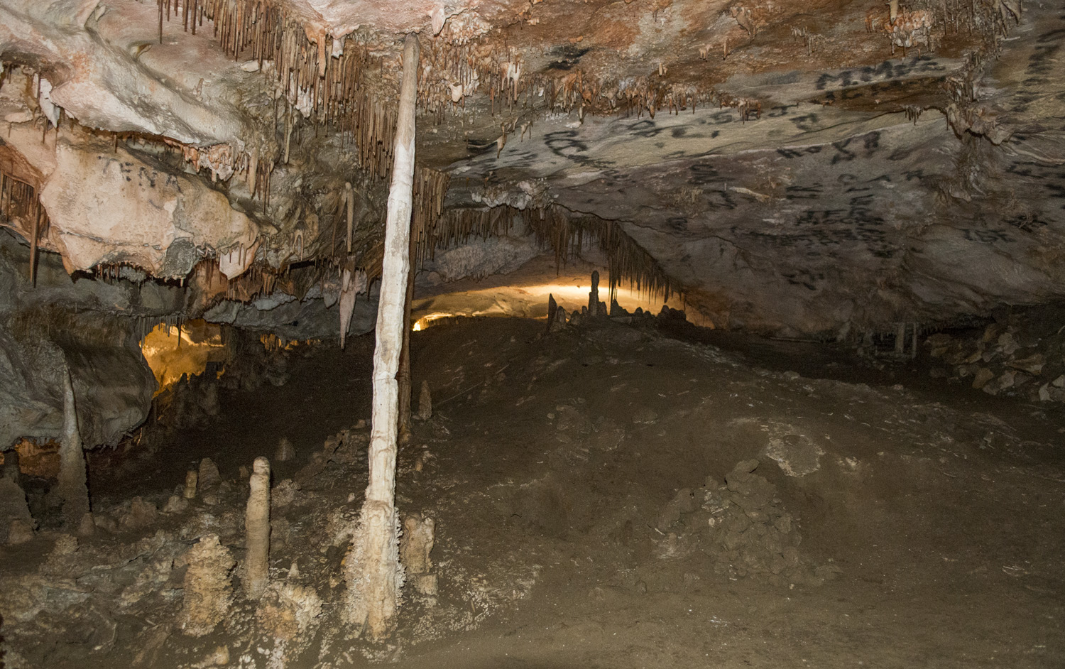
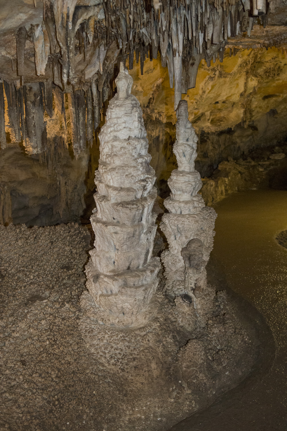
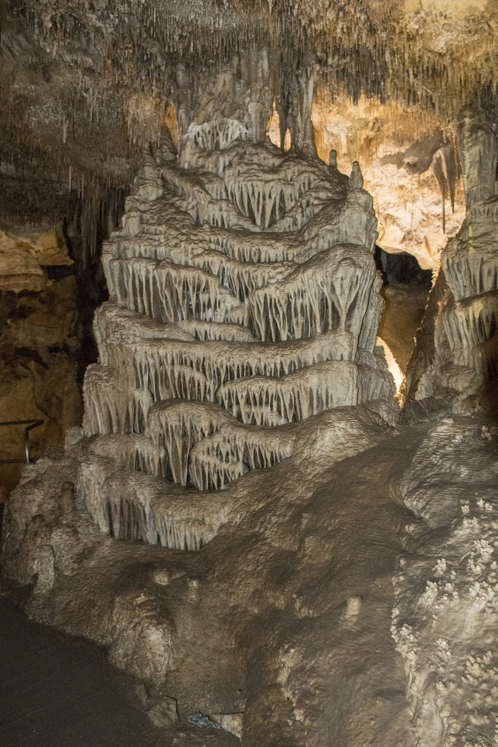
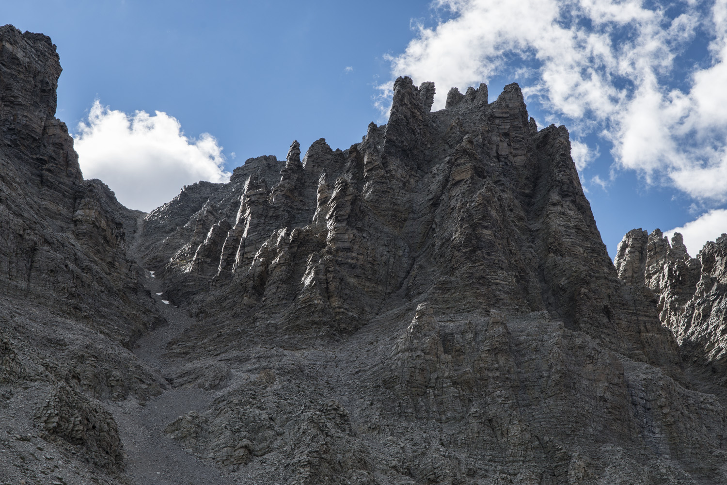
He unlocked the door and we filtered into a long corridor that sloped down. At he other end of the hallway was a door leading into the first room of the cave. It was pleasantly cool inside, as most caves are. There were all the common formations that you'd expect to see in a cave; stalactites, stalagmites, draperies, columns, etc. While Lehman Caves doesn't have the huge rooms or expansive system like at Carlsbad Caverns, Mammoth Caves, or Wind Cave National Parks, they are known for one particular thing; cave shields. While not unique to Lehman Caves, they are generally pretty rare. In Lehman Caves however, they are found in unusually high concentrations with over 300 shield formations. As the name would imply they are shield shaped and can reach up to a couple of feet in diameter, usually sit at an angle, and have ribbon like formations forming on the underside of them.

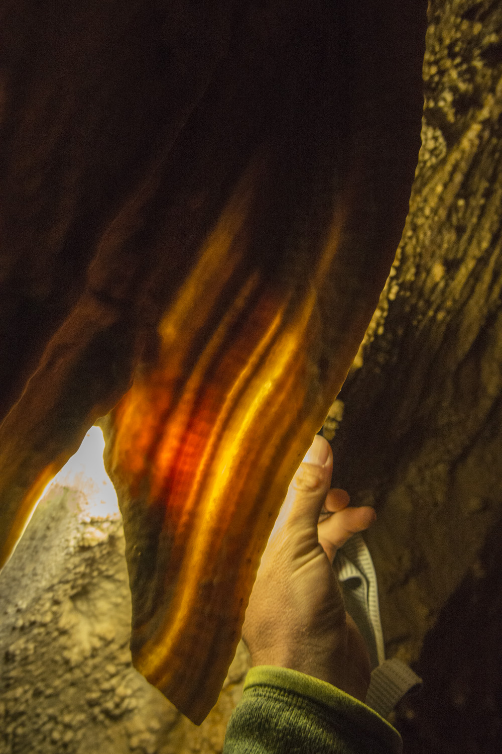
Two of the many shield formation in Lehman Caves
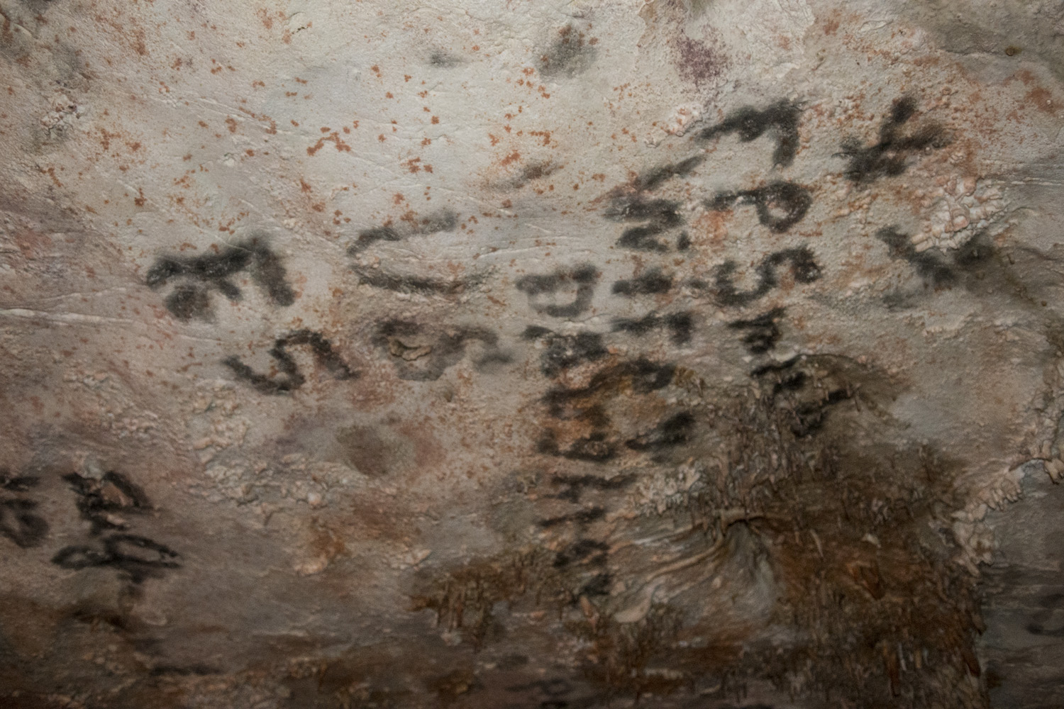
We were brought into one of the bigger rooms that had a flat ceiling. This room contained something that was at once kind of cool but also disheartening; graffiti. This particular graffiti was all over the ceiling and was put there by the early settlers to the area. Apparently Mr. Lehman would have parties in the cave back in the late 1800s and visitors would write their names and other messages in soot from torches. Luckily the graffiti was contained to one room. As much as I would like to go back in time and ask them not to do it, I also appreciate that it's a relic from the past and should be preserved as such.
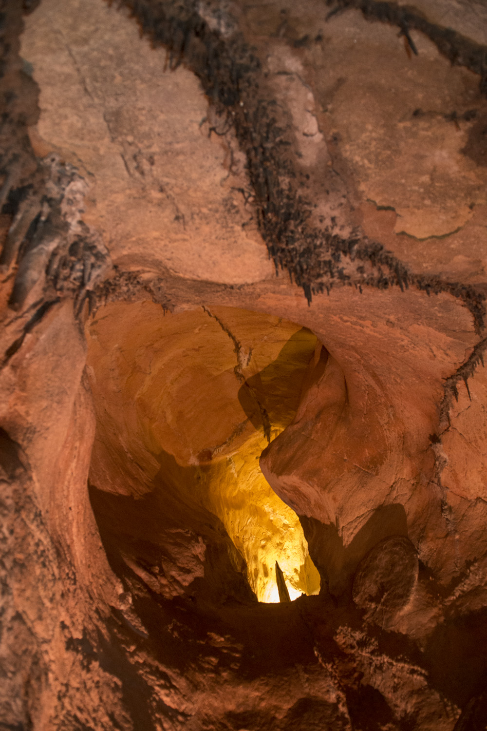
As we continued on the tour, we saw other interesting formations. Soda straws were everywhere. They are hollow, cylindrical stalactites. They vary in length and form in clusters on the ceiling. Another interesting feature that the ranger pointed out to us was 'cave bacon'. It forms in a thin sheet with stripes in the brown/brownish yellow/reddish brown range of colors. And when you shine a light through it, it does indeed look like a giant strip of bacon.
Lehman Cave Photo Gallery:
After the tour, I bought a book on night photography from the gift shop and flipped through it as I had lunch in the cafe. I knew the basics, but it had been a while and I just wanted to brush up. As I headed back up the mountain the cloud situation wasn’t looking so great. By the time I got back to my camp clouds were completely obscuring any view of the sky. There was a short nature trail at the campground, so I walked around for a while. Clouds were still there afterwards. After seeing the brilliant night sky the just 24 hours previously in Utah, I was really hoping to get in some astrophotography while in the park. I made some dinner and decided to pack it in for the night as the clouds were completely covering everything so there wasn’t much I could do. Also, I was getting up really early the next morning to tackle Wheeler Peak, so I wanted to get some rest.
About an hour later I had to go to the bathroom. As I crawled out of my tent I looked up, just to see what I could see, and... sweet Christmas. The clouds had completely gone and the sky had filled with a million points of light. The dense band of the Milky Way was shooting up from between the summits of Jeff Davis and Wheeler Peaks. It was spectacular. Even growing up in the country I had never experienced night skies like this. I knew I immediately had to... go to the bathroom. Hey, when you gotta go you gotta go.
But then, I immediately got my tripod and camera out and started shooting. There was way more sky than I had lens, so I decided to do a vertical panorama. I shot five overlapping frames, starting with the summits of Davis and Wheeler, and then tilting to the sky almost directly above me. The exposure was about 4 seconds at f2.8. Afterwards, when I was able to stitch them together in Photoshop, I ended up with an incredible poster image of the night sky over Great Basin...

The Milky Way over Great Basin National Park. Taken from Wheeler Peak Campground at about 10,000 feet. The mountain at the lower right is Wheeler Peak.
I spent some time shooting the scene, and also just staring at it. It was one of those sights that was a little hard to wrap my head around. I’ve had a long time interest in astronomy, and seeing it on full display like this was truly awe inspiring. I could've sat there all night watching it, but I was starting to get pretty chilled and I did have to get up early. So I packed up my gear and crawled back into my tent to get warm, satisfied that I had captured one of Great Basin's most stellar attractions.
DAY TWO: WHEELER PEAK AND STAR GAZING PROGRAM
Morning came and I got ready to hit the mountain. It had been a few days since Mount Borah and I was feeling much better. Wheeler would be a relatively quick hike; on the trail before sunrise, back for an afternoon lunch. With my headlamp as my only light, I made some breakfast (more dehydrated eggs and tea), put on my pack and was off. The summit trailhead was at the other end of the campground, so I didn't even have to drive anywhere. The trail for people not staying at the campground was a bit longer. I was a good half hour into it before it got bright enough to turn off my headlamp.
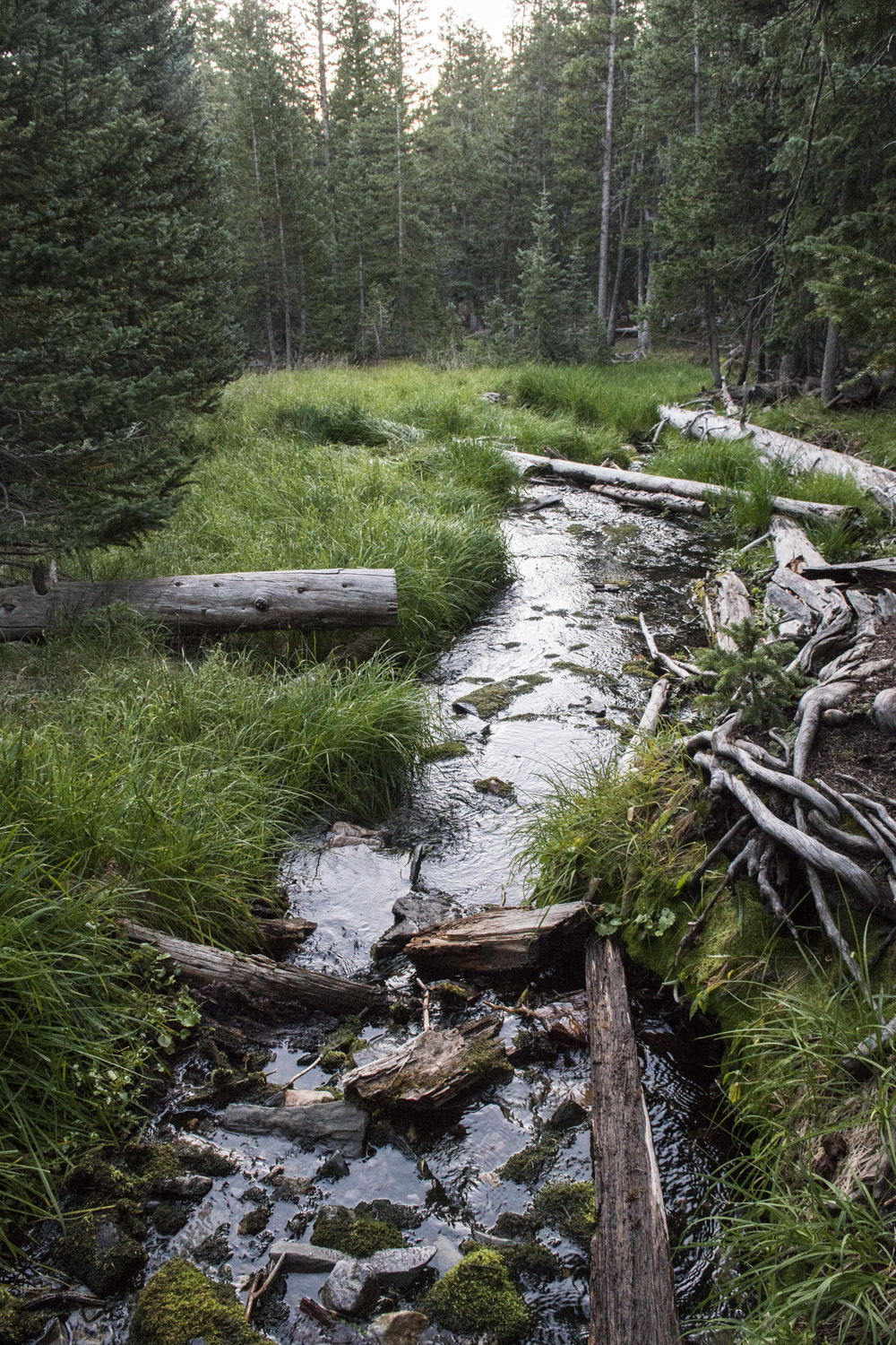
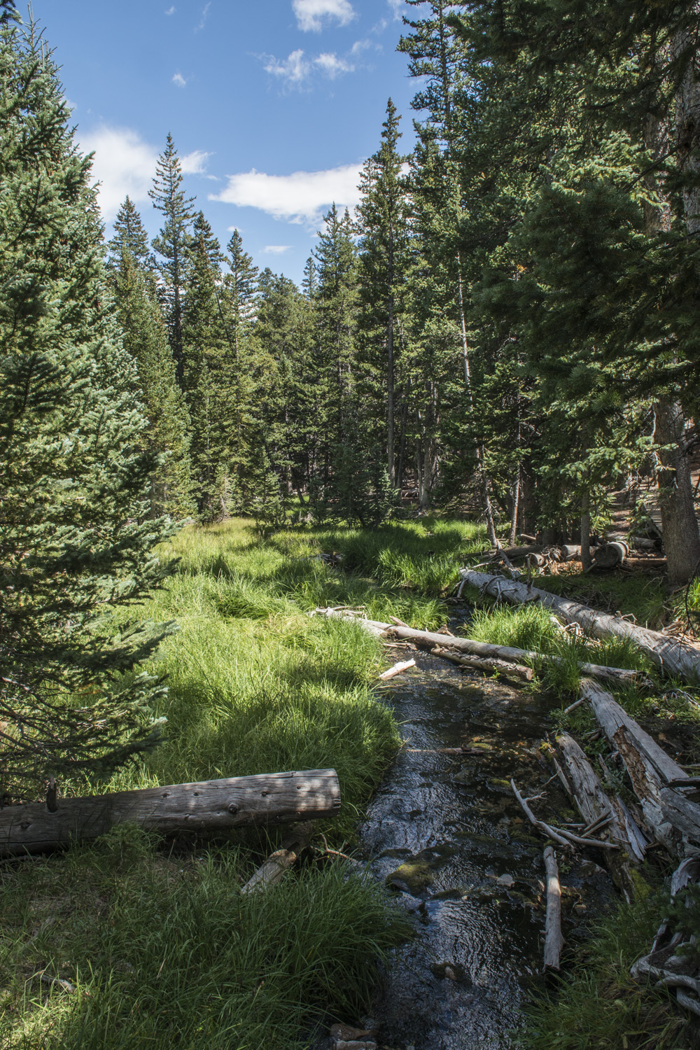
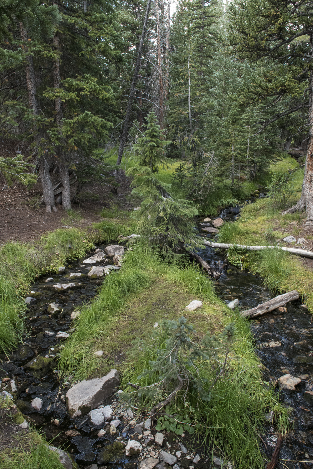
The environment at that elevation is in such stark contrast to the desert surrounding the park. There were tall pine tree forests. Running streams with marshy ground on either side. The air was cool. At this hour I was the only person on the trail. I got to a small clearing and heard some rustling in the woods. It sounded to large for rodents. A ranger I talked to said there were no bears in the park. I heard there were goats in the park, and I had already seen turkeys, so I hoped it was one of those and kept moving.
Before long I came upon Stella Lake, a large pond along the trail with an excellent view of the summit. The pond's mirror-like surface reflected the mountain behind it. This was about the point where the environmental zone started changing yet again. The pine trees rapidly started getting smaller and more sparse. The grasses thinner and drier. I wouldn't have much shade for the rest of the hike.

Stella Lake with my destination, Wheeler Peak in the background.

Wild turkeys on the trail to Wheeler Peak.
Just above Stella Lake I saw a small flock of turkeys. I still wasn't too far from the campground so I wondered if they were the same group I had seen the day before. They came pretty close to the trail and almost seemed to be following me. I stopped for a moment to see just how close they would come. About 20-30 feet before they changed course into the dwindling tree cover.
A couple hundred yards after Stella Lake was a major switchback, turning the trail from the western and northern directions it had been following to a southern one toward the summit. This would be the last major reference point along the trail. I like having references to gauge how far I've gone and how far I have yet to go. From here on out I would be making my best guess, using the park brochure map, to tell how far along I was. And I still had the bulk of the elevation gain yet to come. One foot in front of the other...

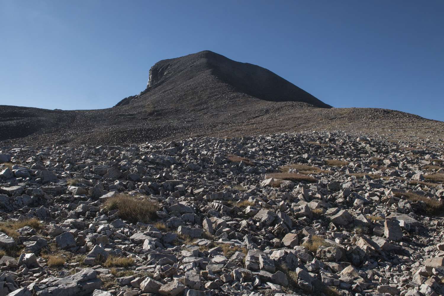
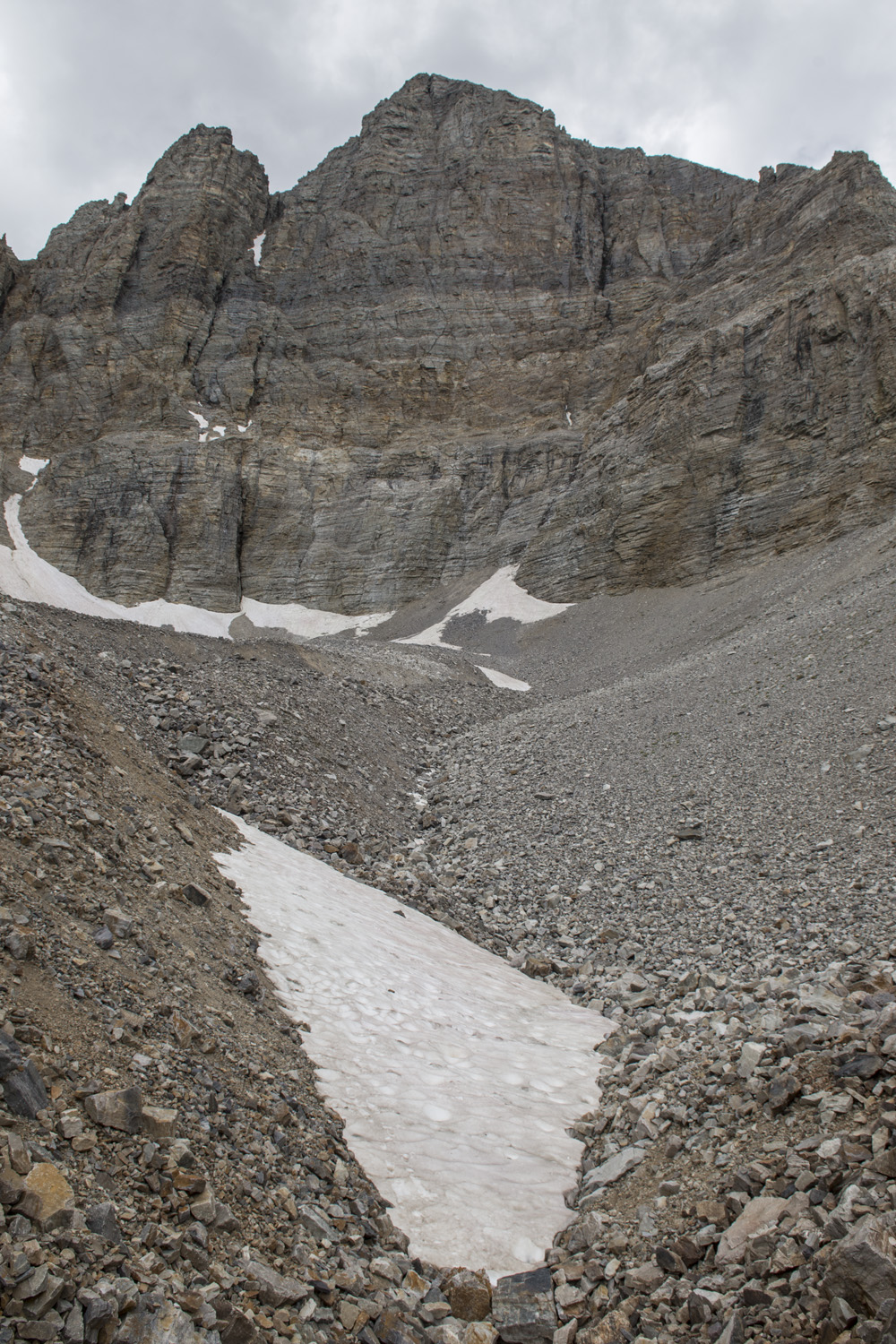
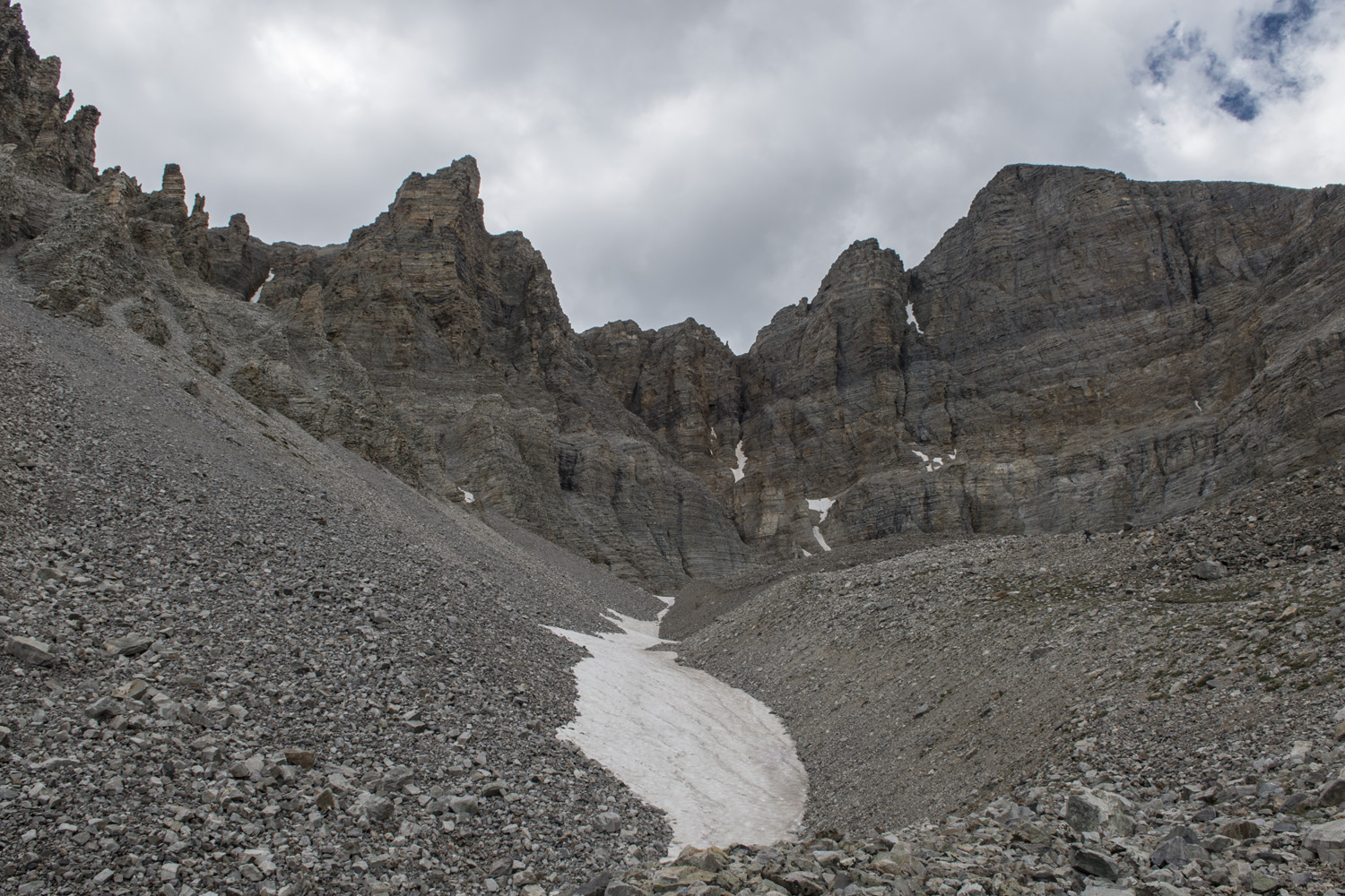
The trail above tree line. The scree goes all the way up.
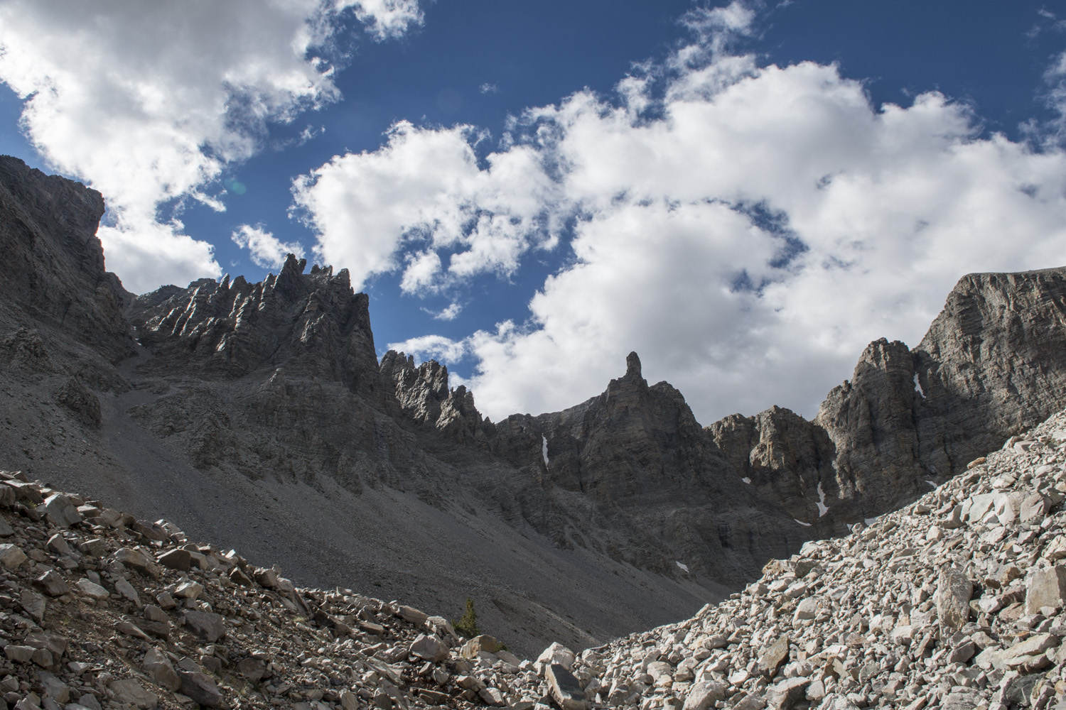
The next stretch was an almost flat section that traversed the side of a slope for about a quarter mile. Not a big distance, but a chance to quickly cover some ground before the major uphill started. The flora continued thinning. The trees had shrunk down to glorified shrubs. Grasses gave way completely to loose rock, or scree, which would continue all the way to the summit. Eventually, even the shrubs stopped and there was nothing except the scree. It was like a different kind of desert up there. Luckily the trail was well trodden, so the scree had mostly settled. It was better than some of the stretches on Mount Borah from earlier in the week.
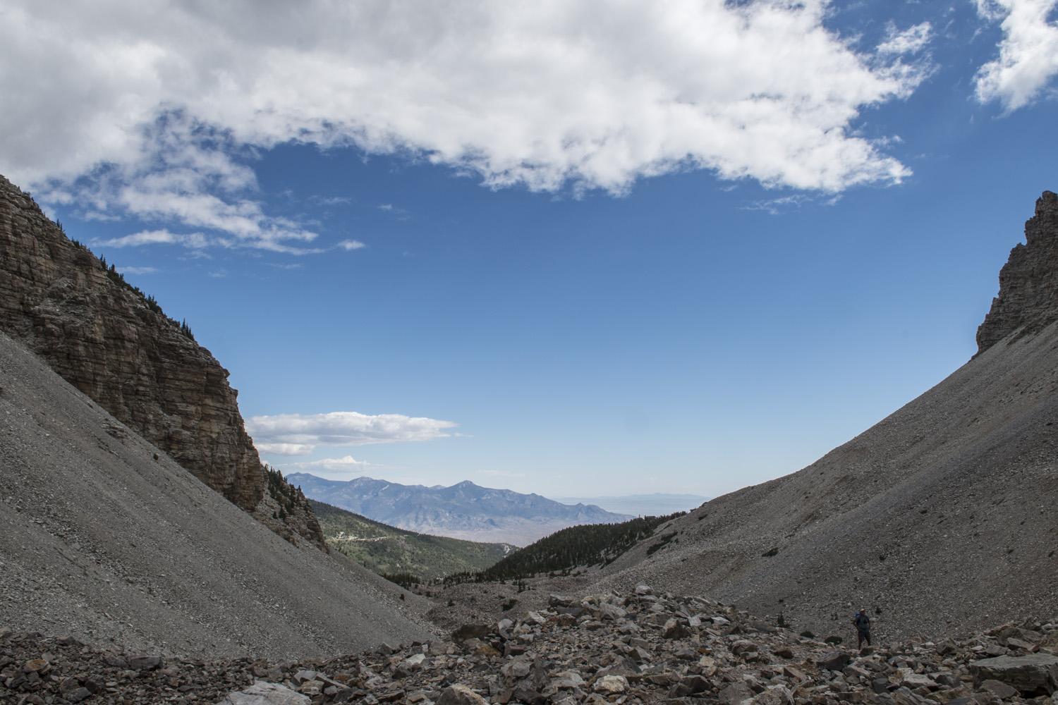
As I got onto the main ridge leading to the summit, I started getting views to the west of the park. Despite being in the middle of nowhere, the arid desert floor showed signs of life. There was a huge windmill farm. Just down the road from that were crop fields with their signature circular patterns. They didn't seem that far away, but the windmills were ten miles from where I stood. The views, however, went much farther than that.
I eventually saw other people on the trail behind me. I don't move too fast going uphill, so they were slowly gaining on me. I just kept plodding along. From the campground the slope didn't look quite that steep. It's always a different story once your on the mountain. A mountain like this, even if it is fairly straightforward, still takes a lot of work. The rest of the hike was fairly uneventful. Just working my way up the slope, dealing with the not terrible scree, taking in the scenery, watching for weather.

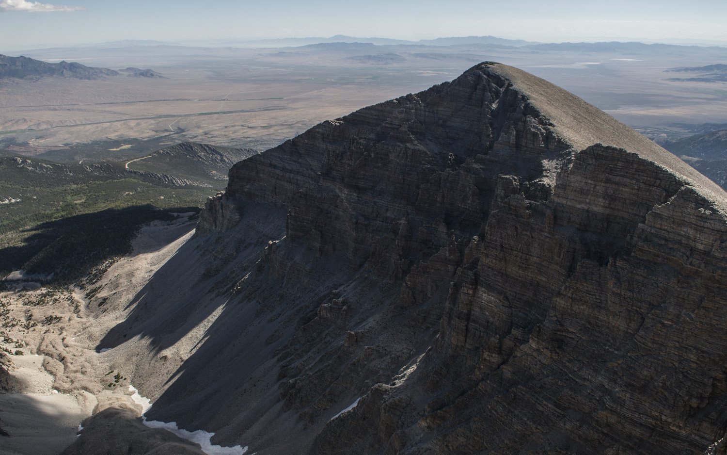
On the summit of Wheeler Peak. Notice the rain in the background.
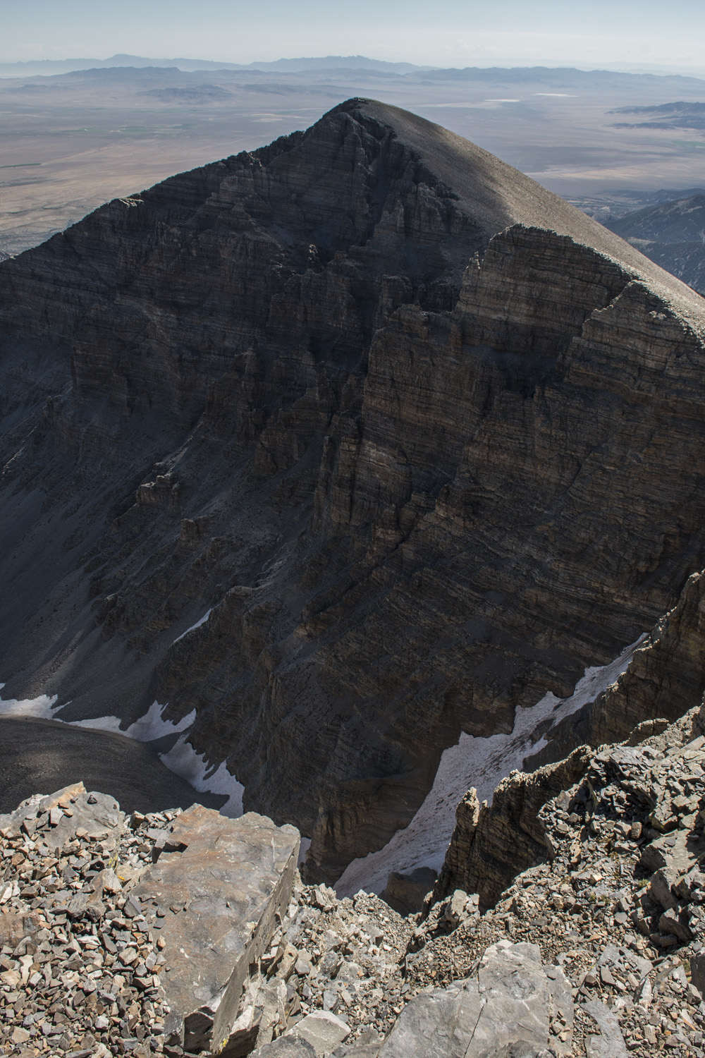
At long last I came upon the summit. The summit area had a long ridge that was mostly flat and about 100 yards long. It was visible from the campground as a distinctive feature. There was a small wind break at the western end of the ridge that had been built out of rocks where I took off my pack and took a break. The eastern end of the ridge looked like it might be slightly higher so I walked over to that end. Once I got there, the end I had just come from looked higher. Well, I stood at both ends just to cover my bases, but I believe the western end of the summit ridge was the highpoint. The eastern end, however, had spectacular views of Jeff Davis Peak, the huge saddle between the summits, and the rock glacier and moraine down below (where I would be hiking to the next day).
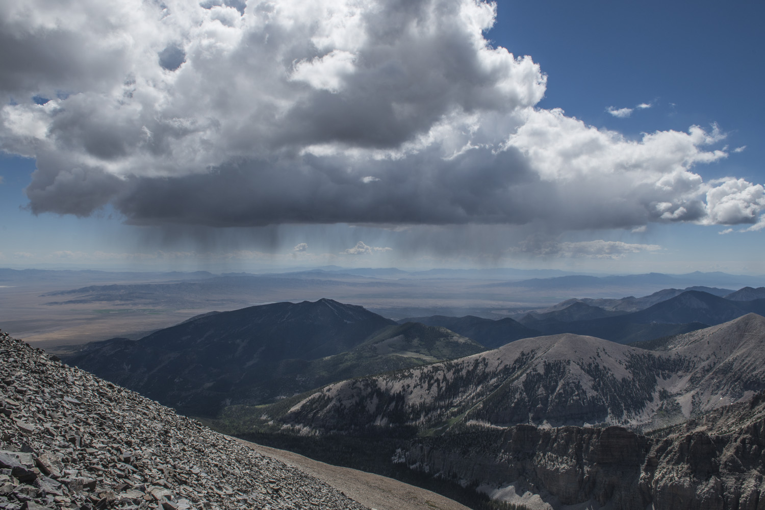
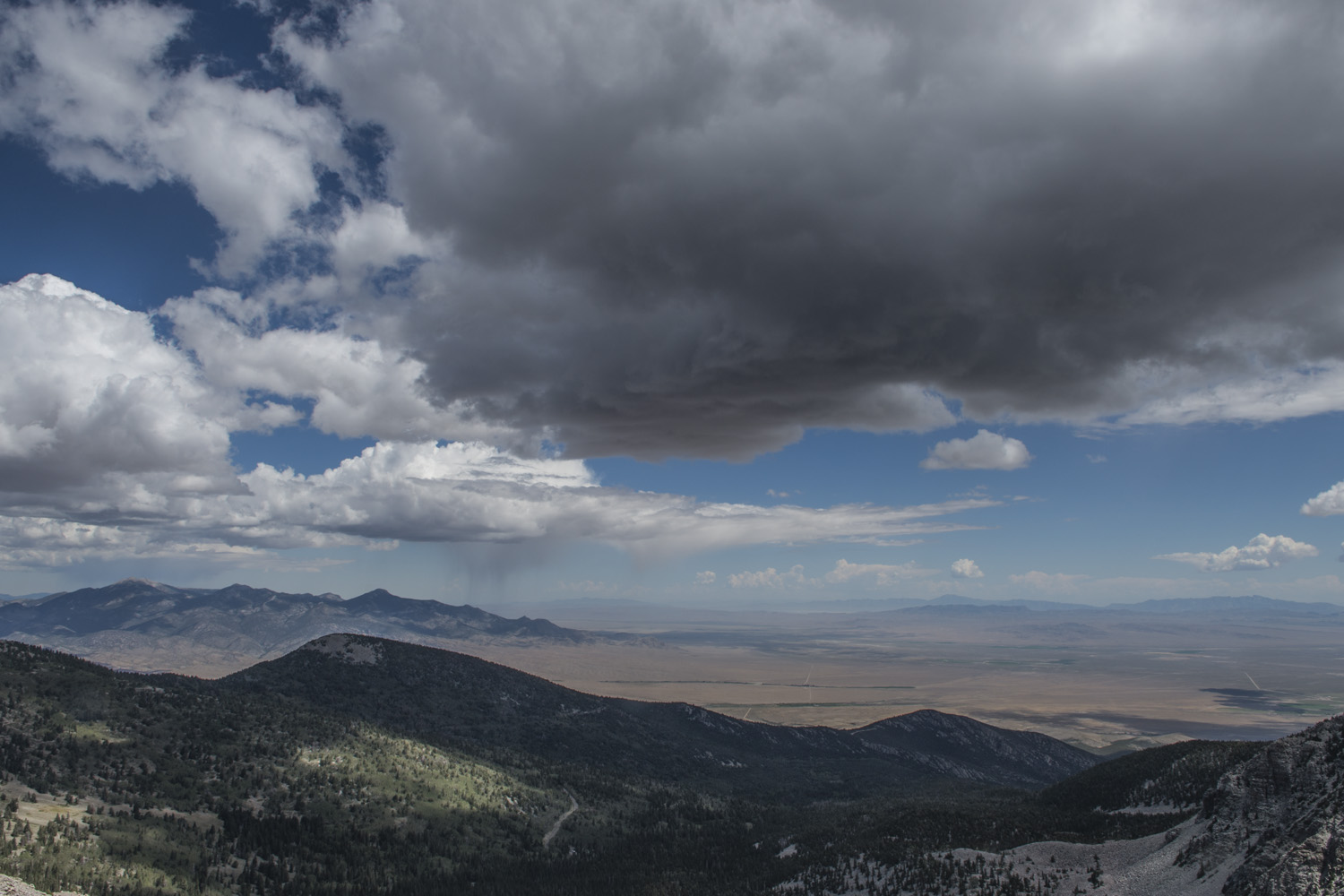
I went back to the wind break to have a snack, relax, and take some pictures. A few more people started reaching the summit. After a while I noticed some dark clouds coming from the south. They seemed to be slowly making their way toward the summit. Plus they were starting to rain. Several of us noticed this and decided to start making our way back down. They looked like isolated cells, as opposed to entire storm fronts, but still, better to be safe. This is why I always try to get a really early start when heading for a summit; to avoid the afternoon storms.

360 view from the summit of Wheeler Peak
So I packed up and began to make my way back down. Contrary to popular belief, going down is not necessarily easier. At least for me. The scree in particular makes it difficult to get any speed going. You're too busy watching every single foot placement, which can be mentally exhausting. It took me about as long to get down as it did to get up. As I was going down I started getting a headache. I figured it was the altitude.
I've been trying to figure out what my altitude tolerance is but it doesn't seem to be very consistent. Wheeler Peak, at 13,063 feet, was triggering some mild altitude symptoms (headache) after only about an hour on the summit. Just a few days prior, however, I had spent six hours on the summit of Mount Borah which has a summit elevation of 12,662 feet with no ill effects. I was sore from that hike, but showed no altitude symptoms. Could that extra 400 feet have made the difference? But then, when I was in Montana doing Granite Peak the previous year, I was showing mild symptoms at around 10,000 feet. Would be really nice if I knew what to expect.
The headache was making me feel kind of miserable. After passing Stella Lake and getting back in to some wooded areas, I stopped to just sit down for a while in the shade and close my eyes. I was really close to the campgrounds, but I just needed to stop. After a while I got back up and finished the short distance to my camp site. It was only early afternoon and the only other thing I had on my agenda for the day was the astronomy program that night at the visitor center which didn't start until near sunset. So I crawled into my tent and collapsed onto my air pad and sleeping bag and slept off my headache for a few hours.
Hike to Wheeler Peak Photo Gallery:

Stargazing program at the visitor’s center. The clouds are not a good sign.
After a much needed nap and a bite to eat down at the visitor center I got ready for the evening's ranger program. They had closed off the upper parking lot of the visitor center and set up two large telescopes. Once it was dark enough we would be checking out various objects, with the big one being Saturn and it’s rings.
It was the same ranger that had lead the cave tour. A Jack of all trades apparently. While it was still dusky he did his presentation about what we would be seeing. As night fell we split into two groups to line up for the telescopes. Unfortunately this would prove not to be the best night for it. One of the telescopes was having alignment issues, and the increasing cloud cover obscured the night’s guest of honor, Saturn.
A secondary target was selected, which wound up being a nebula. I’ve seen Saturn through a telescope before, so that wasn’t such a huge loss. A nebula on the other hand I had never seen so that was pretty cool.
Though it wasn’t the best night for star gazing, it was still interesting, and I still had the experience of the previous night seeing those amazing, star-filled Great Basin skies.
DAY THREE: BRISTLECONE PINE GROVE AND ROCK GLACIER

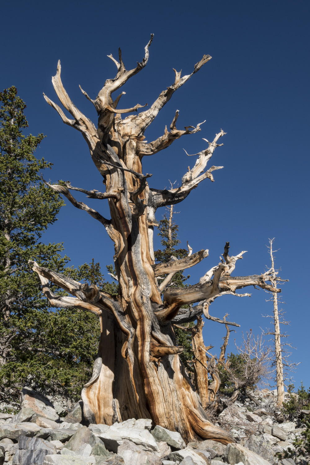
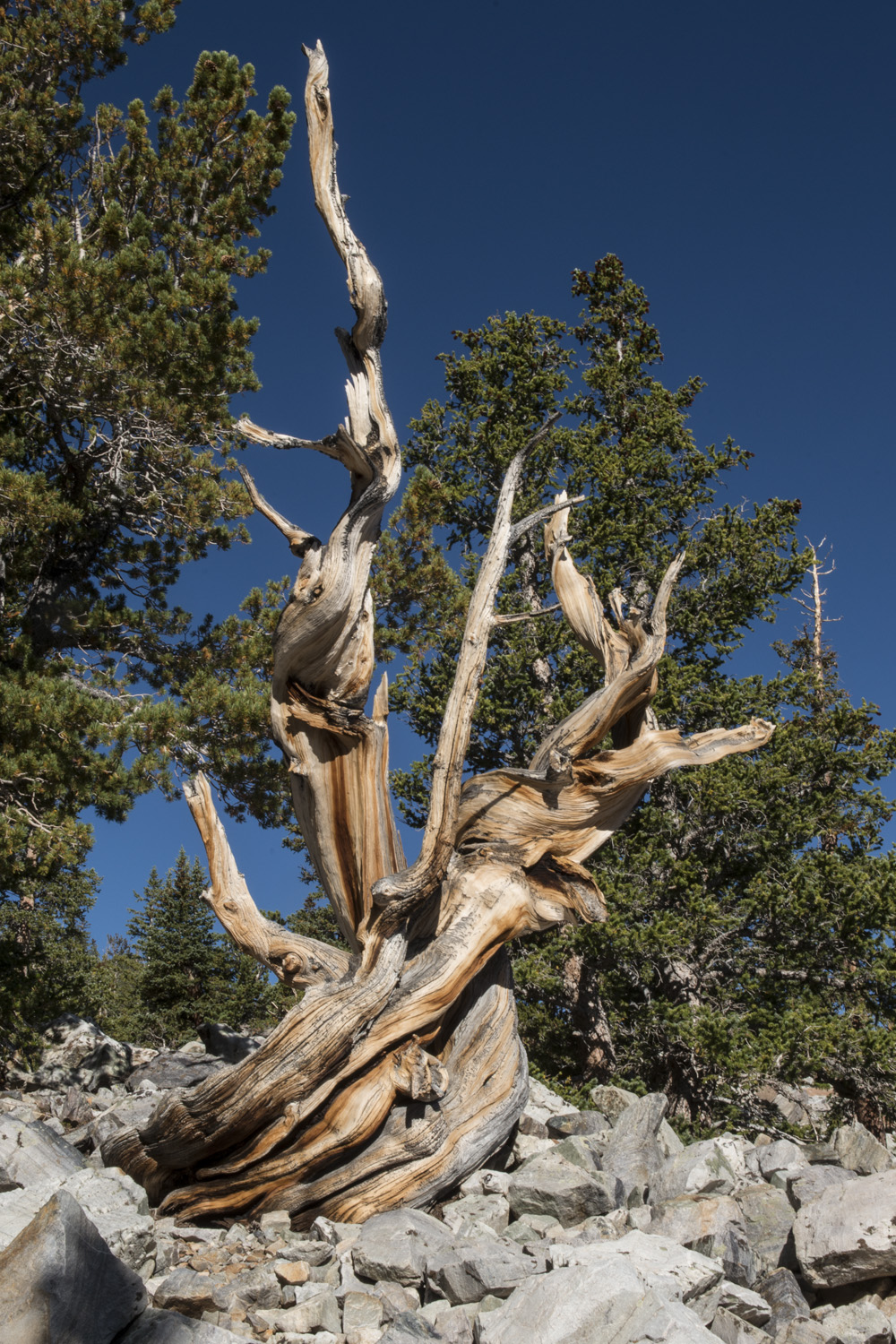
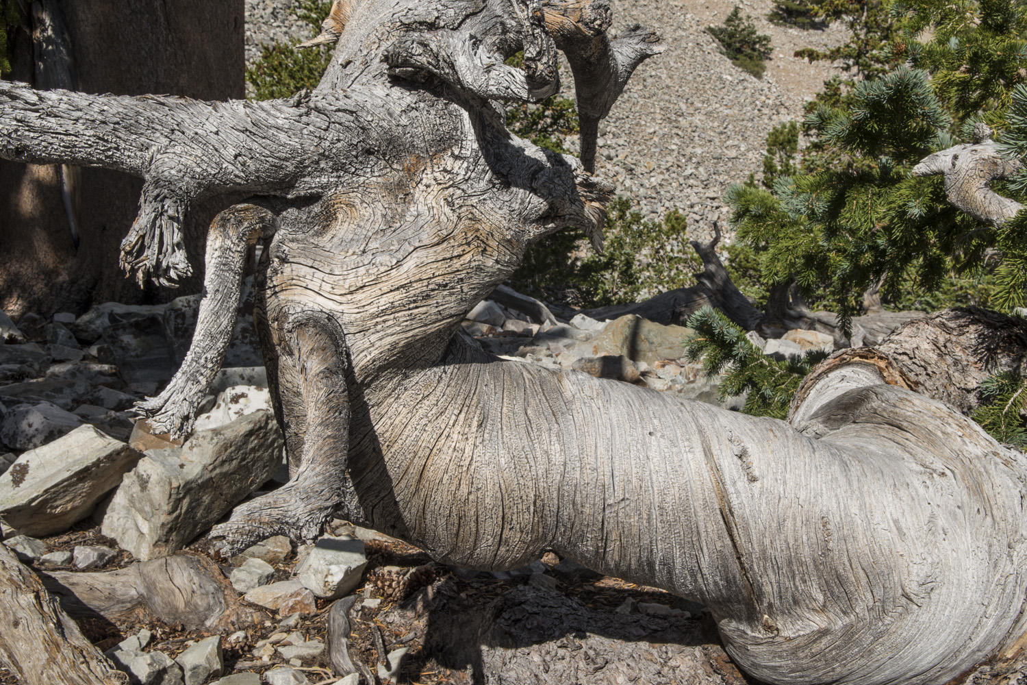
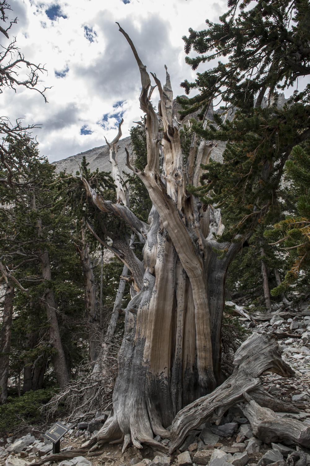
One of the ancient bristlecone pines.
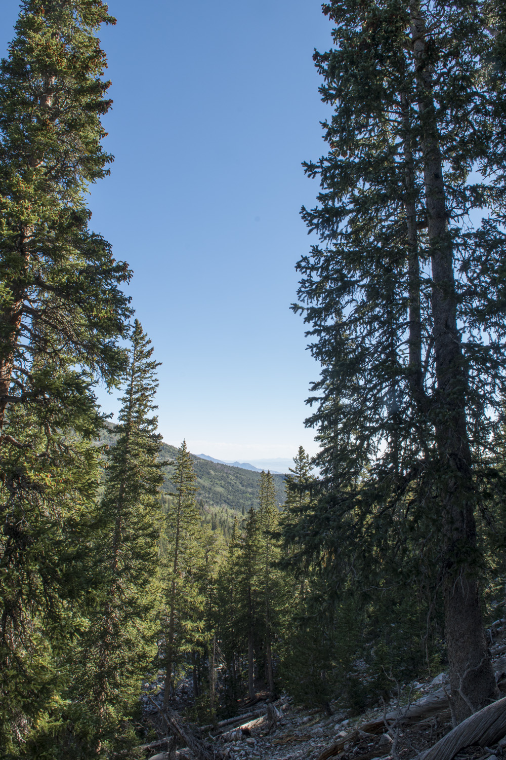
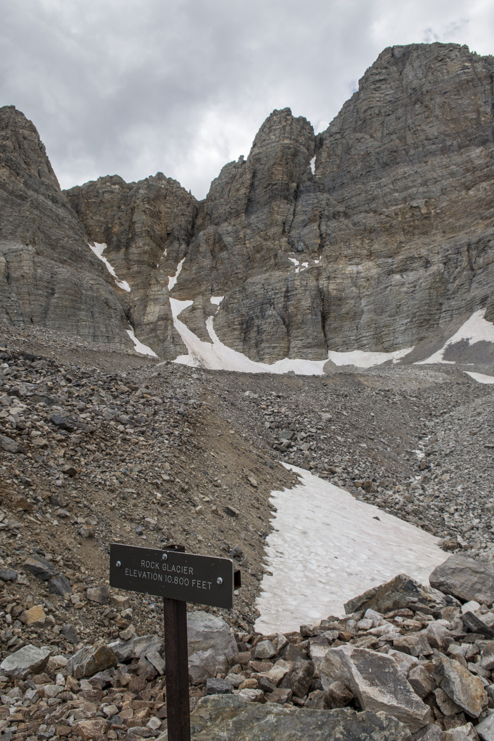
The next morning I woke up and packed up camp, but I wasn’t leaving quite yet. I had one more adventure in Great Basin. I would be hiking a relatively short and not too steep trail (2-miles one way and less than a 1,000 feet of gain) up to the the glacial cirque below Wheeler and Jeff Davis, which is home to Nevada’s only glacier. The cirque makes the mountain look something like a blown out volcano, like Mount St. Helens, although it isn’t a volcano. Along the way the trail goes through a grove of bristlecone pines, some of the oldest living organisms on the planet. The trail is creatively called the Glacier & Bristlecone Trail.
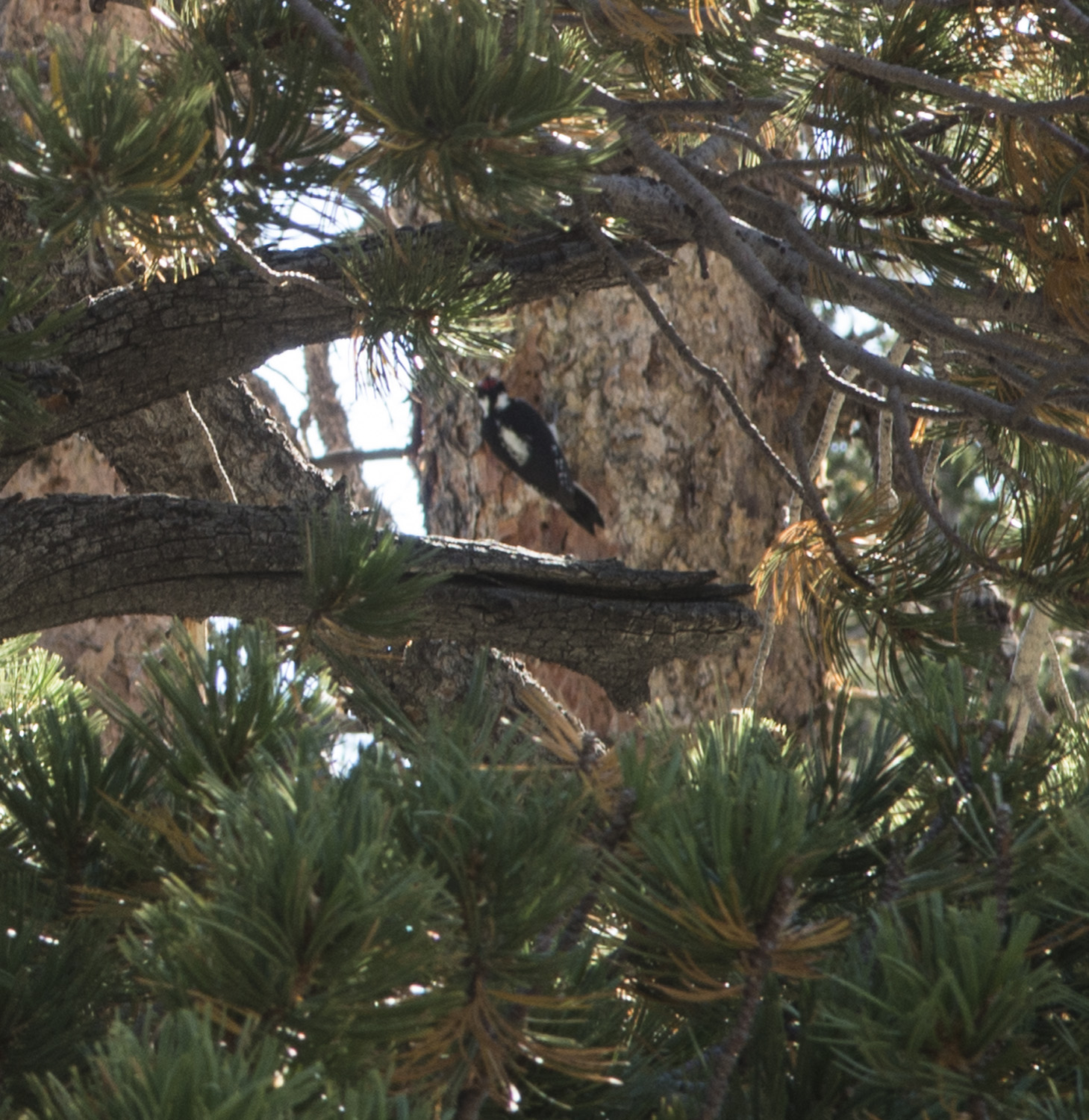
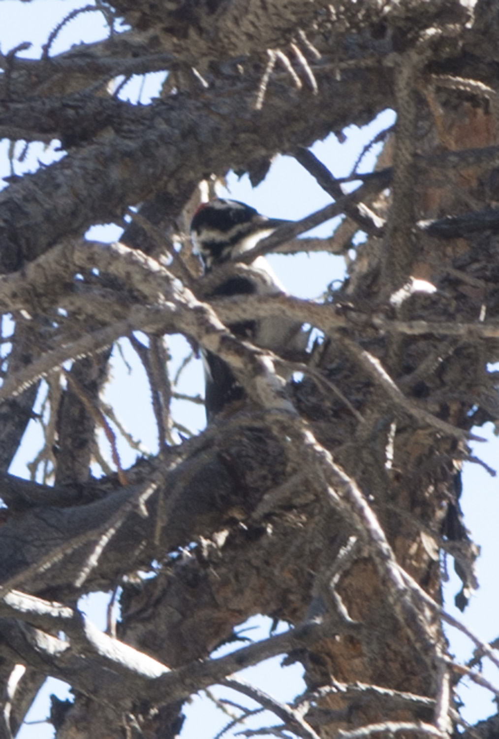
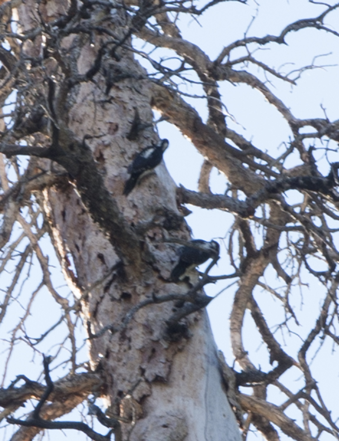
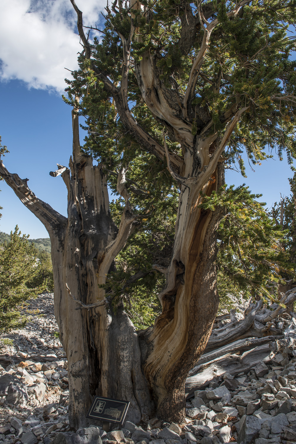
The hike up to the bristlecone grove was pretty straight forward and easy. I even glimpsed some Downy woodpeckers. After a short while, I came upon the interpretive trail through the bristlecone grove. I was excited to see them, as I had heard about bristlecones for years but had never actually seen one. The trail was only about a tenth of a mile, but passed many trees.
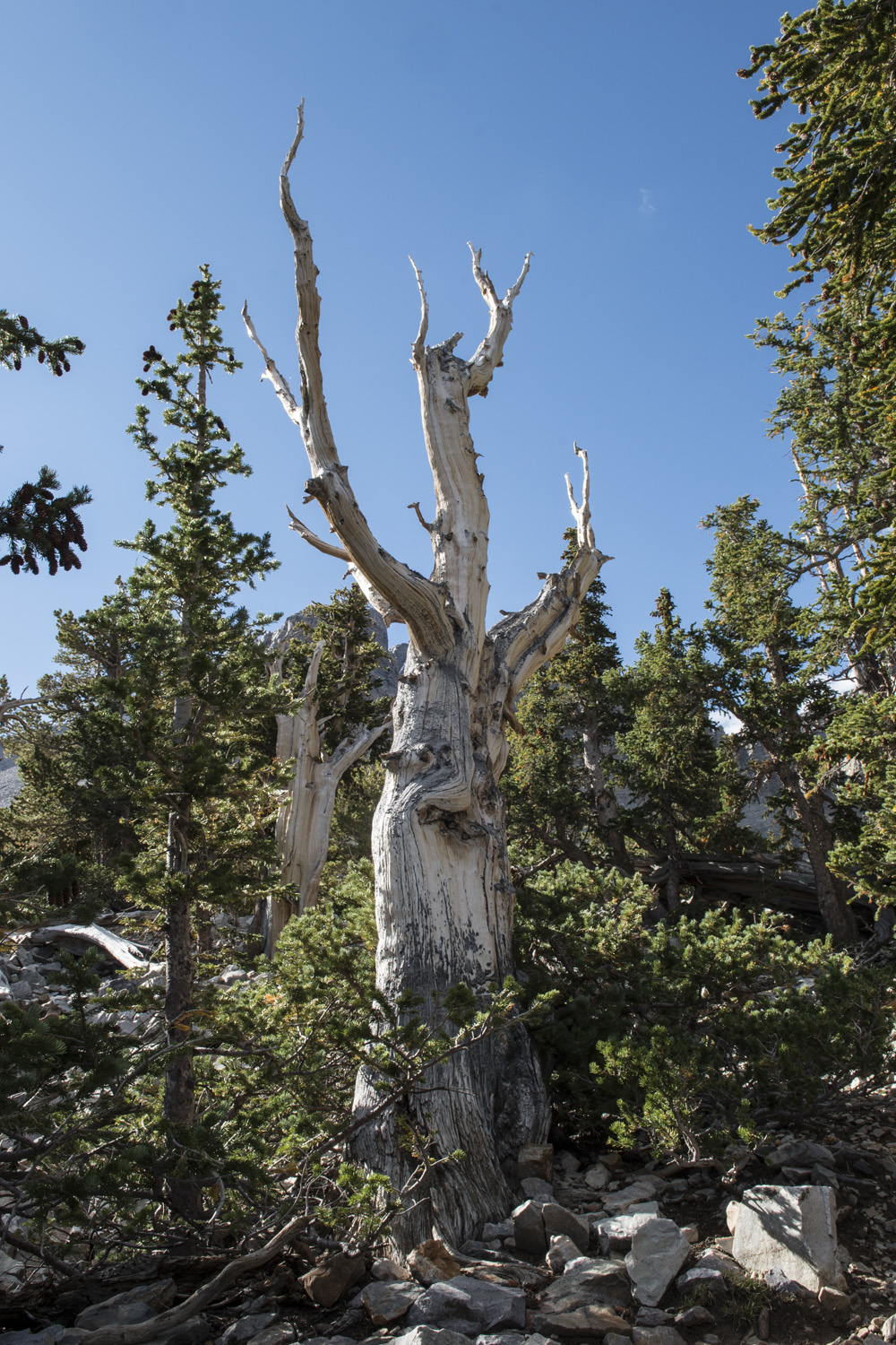
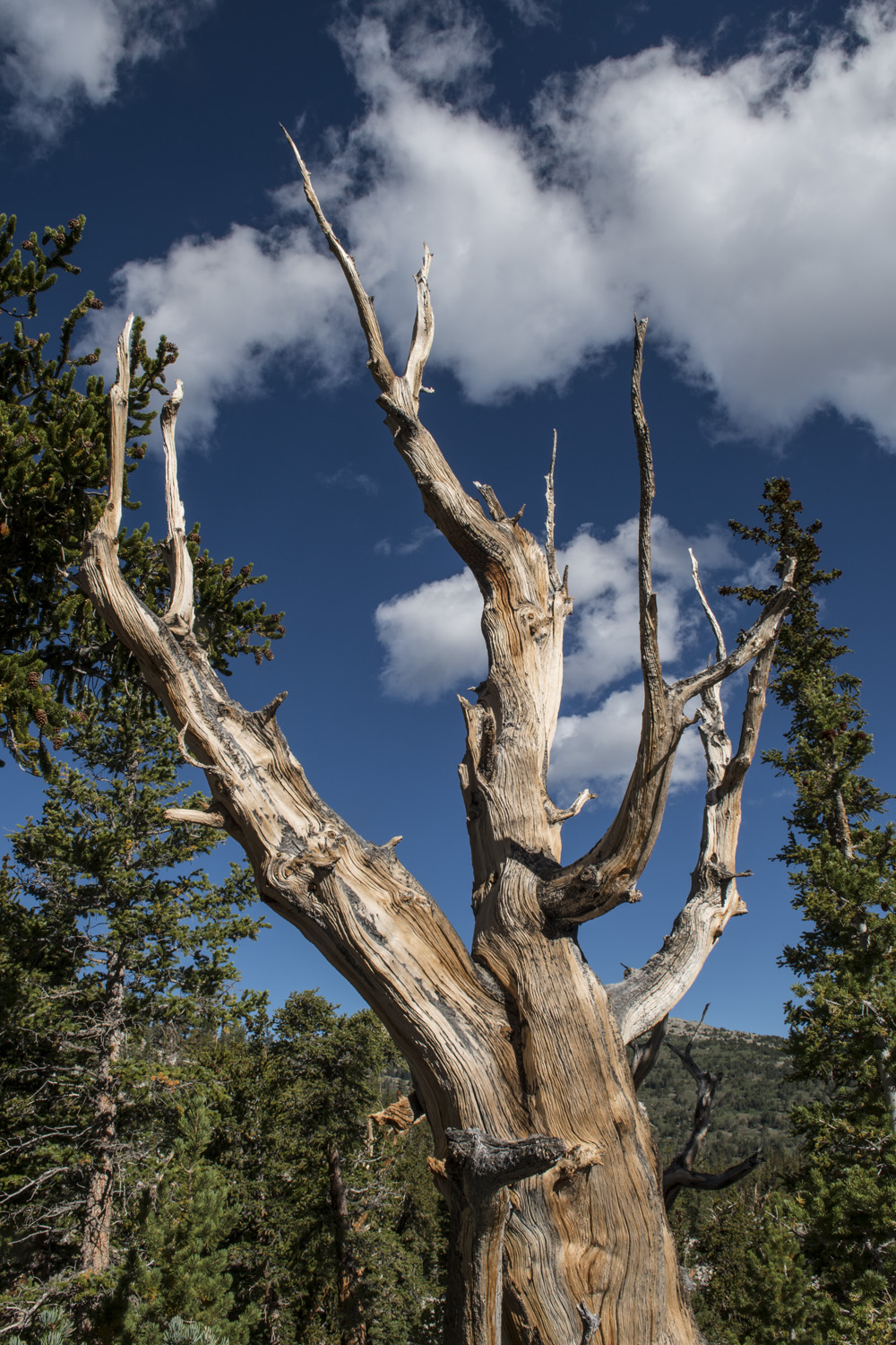
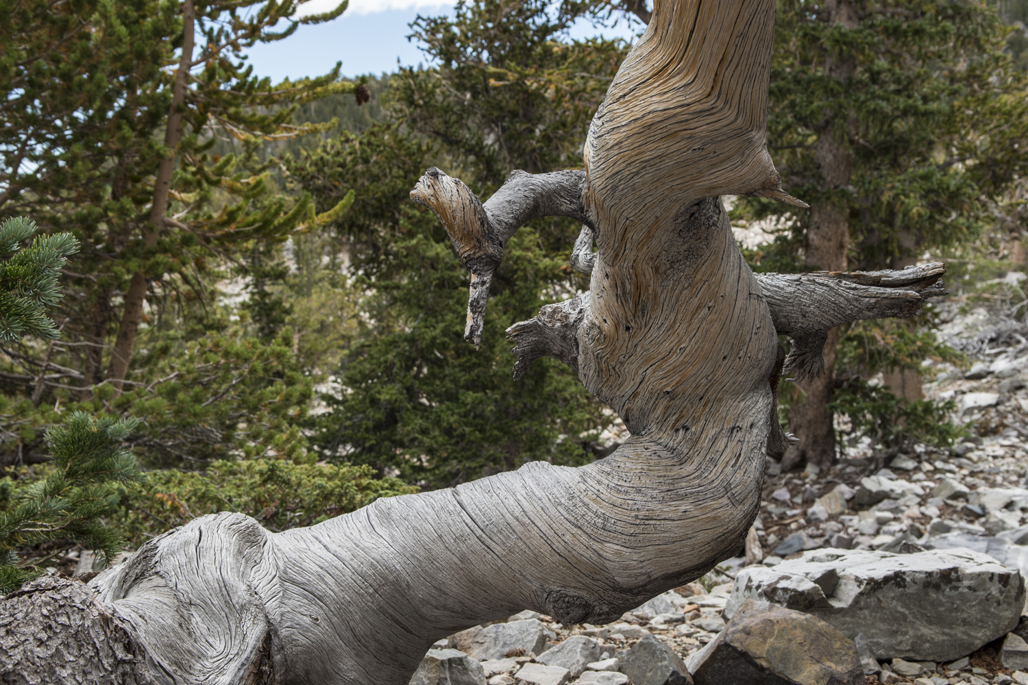
Bristlecones are a truly amazing organism. From an aesthetic point of view their twisted, gnarled limbs look like something out of a Tim Burton fever dream. They often seem to be mostly or completely without bark, yet still alive. They’re fibrous, resin filled structures makes them particularly resilient to the elements, even forest fires. This resilience means that they can grow to be very, very old. One of the oldest trees along the trail is over 3,000 years old. It was just sprouting when Ramses VII was pharaoh of the Egyptian empire. And that tree isn’t even close to being a record holder for the species (over 5,000 years!).
Another specimen in the grove was sadly dead, but it wasn’t due to disrespectful park visitors damaging it. There was no established park when it died. There was no United States when it died. In fact, there were no Europeans in North America when it died. It is estimated to have died a century before Columbus. Aside from a total lack of needles, it really doesn’t look all that different from the living trees in the grove. Their physical properties mean they don’t really rot, they instead erode very slowly. This particular tree was not just still in tact, but still standing tall after having died 600 years ago.

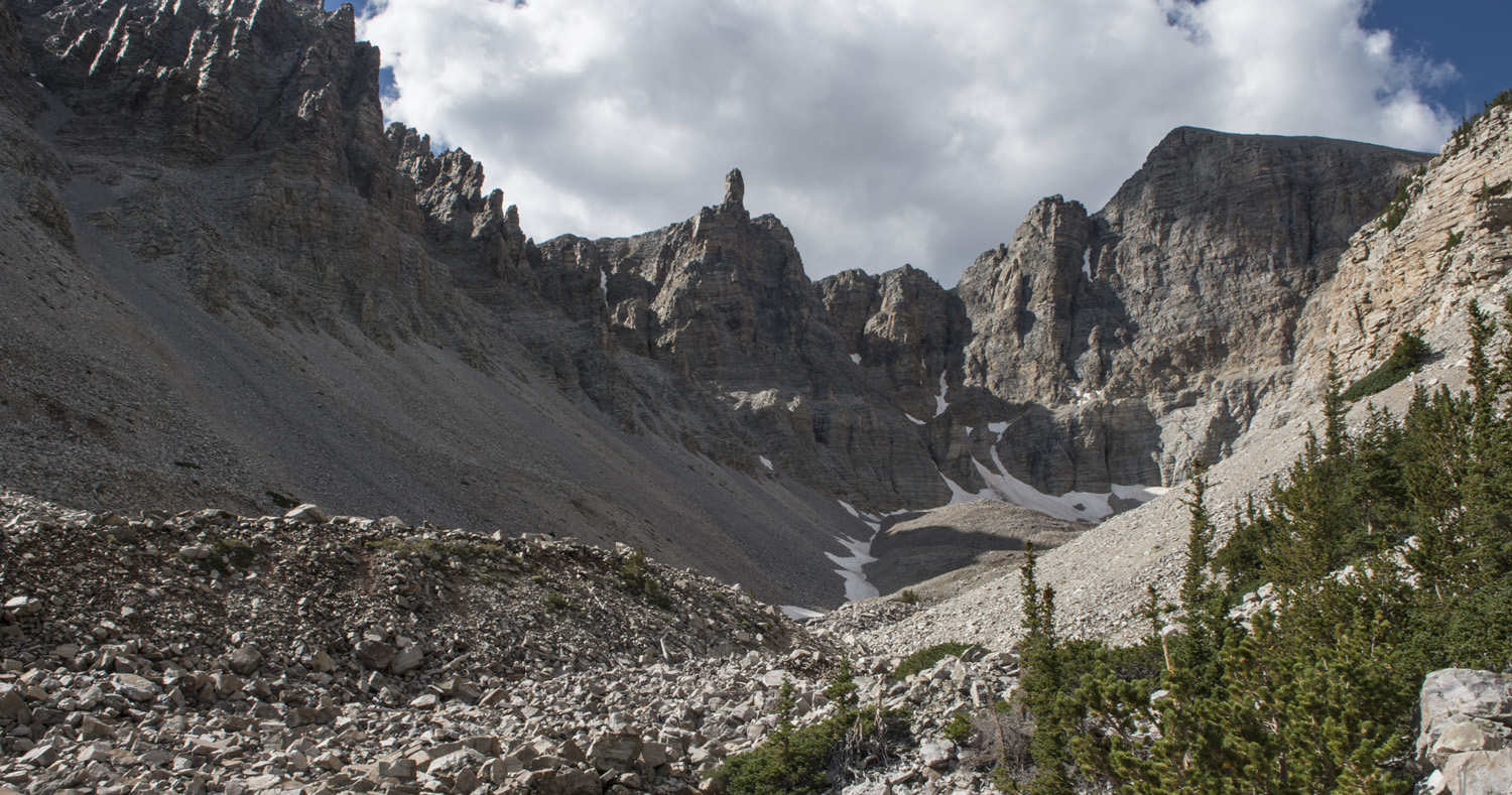
The glacial cirque below Wheeler Peak.
Next stop was the glacier at the end of the trail, less than a mile from the grove. Along the way I met a gentleman named Tim, and we chatted as we hiked up to the glacier. Being Nevada’s only glacier, it’s kind of a big deal. However, as far as glaciers go it is pretty small. The upper sections looks more like large snow banks, and apparently most of it is buried under rock. The setting though is spectacular. Nestled in the back of the cirque, it is surrounded on three sides by the steep cliffs leading up to Wheeler and Jeff Davis Peaks. The open side of the cirque, which faces north-east, looks over to the neighboring mountain range to the north and the horizon beyond. Near the look out for the glacier Tim and I met a couple from Australia. We all visited for a while, exchanging travel adventures. I always enjoy meeting other travelers on my journeys. After a time, Tim and I started heading back to the trail head.
Bristlecone Pine Grove/Rock Glacier Photo Gallery:
My car was closer, so when we got back to my car I gave him a ride to his car and said goodbye. It was time to start heading to my next destination, Bryce Canyon National Park. They also had a first come first served campground and I wanted to make sure I got a spot that night, and I still had about a four hour drive ahead of me. Always adventuring…
Epilogue: As I was driving away from Great Basin on Rt. 21, I entered more of that desolate country like I had seen on Rt 50. For a 75 mile stretch between Garrison and Milford, there was no other traffic, no towns, no houses (save for one lone ranch), no signs of human activity at all. And with no trees I could see for miles. The topography in this area has a series of small ranges running north-south at regular intervals with valleys in between and Rt. 21 runs east-west perpendicular across these ranges. Hills really, with not a lot of elevation gain but noticeable none the less. When I crested one range I could see the crest of the next range in the distance. I wanted to know how far away the next crest was so I took note of my odometer on one crest then picked a spot on the next crest where I would look at my odometer again. It was 14 miles away. The vast emptiness in this part of the country is almost mind numbing. I did eventually get back to civilization and on to Bryce Canyon.
Other posts in this series:
White Butte, Highpoint of North Dakota. Really? More Goats?
Mount Katahdin, Highpoint of Maine. If At First you Don't Succeed...
Hawkeye Point, Highpoint of Iowa. So... Much... Corn...
Granite Peak, Highpoint of Montana. I Have Seen The Top Of The Mountain, And It Is Good.
Mount Borah, Highpoint of Idaho. The Great American Eclipse Of 2017.
Tri-Point Of Iowa, Nebraska, And South Dakota. Hot. Damn Hot. Real Hot.
Sassafras Mountain, Highpoint of South Carolina. Please excuse our mess.
Ebright Azimuth, Highpoint of Delaware. Rock bands and space shuttles.
Charles Mound, Highpoint of Illinois. A farmland stroll.
Tri-point of NC, TN, and VA. My car meets its match.
Mount Rogers, Highpoint of Virginia. OH MY GOD!!! LOOK AT ALL THE FUZZY PONIES!!!
Guadalupe Peak, Highpoint of Texas. Birth of an obsession. And big freaking bugs.