
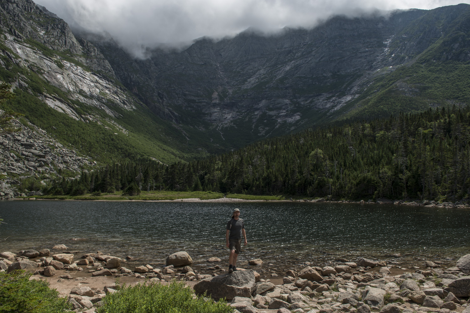
Mount Katahdin, highpoint of Maine. The man on the sign is 'Sniffles', an AT section hiker finishing almost 800 miles of the AT.
Failed attempt: July 17, 2013
Successful Summit Date: July 18, 2017
This was a highpoint that ate at the back of my head for four years. The first highpoint convention I attended was in Maine in 2013. I had my hike all scheduled and headed out with some new friends from the convention. We planned on taking the route that would take us over the (in)famous Knife Edge, a nearly mile long ridge with steep drop off the whole way. Unfortunately, mother nature had other plans.
The big thing that killed this attempt was the late start. Baxter State Park runs a tight ship and they control how many people are in the park and when they can be there. Since we were all staying in Millinocket, almost an hour from the trail head, we would have to wait for the rangers to open the main gate, which wouldn't happen until 6:00 a.m. That sounds early, but we were hoping to be on the trail well before that. With the late start we got to Pamola Peak just in time for the midday storms to roll in. When we got to Pamola Peak (at the east end of the ridge) we saw some nasty looking clouds coming in from the west over the summit. Despite being able to see the summit cairn, we made the decision to turn back. I didn't have another chance to attempt it that week, so I returned home having failed to summit Katahdin. For four years I thought about getting back there. It was a bit of a sore spot every time I looked at my map. When the decision was made to hold the 2017 convention in Massachusetts, I knew this was my opportunity. I shall return.
I would take a much different tack this time. Instead of trying to do an eight mile round trip route in one day like before, I would break it up and hike in to Chimney Pond campground for two nights. This would put me just 1.8 miles from the summit. And since I would already be in the park I could start as early as I wanted, with two days to make an attempt. The plan was set. There was only one thing left to do before I hit the trail; drive to New York City to see one of my favorite bands, The Naked And Famous, live in concert. What can I say, I pack a lot in to a vacation.

The route for my hike in to Chimney Pond campground
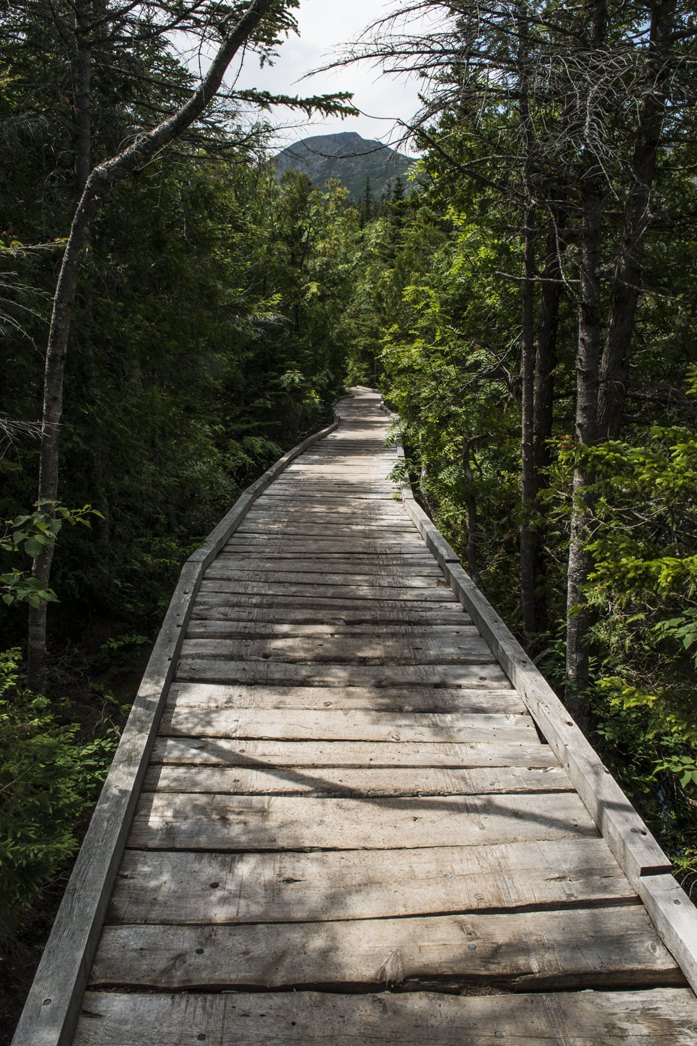
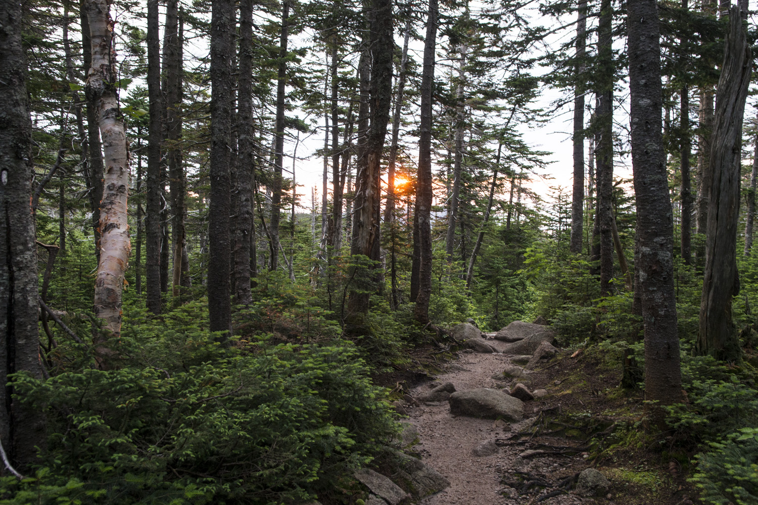
So anyway, after arriving at the park I checked in at the gate with the rangers and made my way up to Roaring Brook trail head. This was the end of the road and trail head for several trails leading into the park. One of these is the Helon Taylor Trail, which leads up to the Knife Edge. That's the one our doomed expedition took back in 2013. This time I would be taking the Chimney Pond Trail and not coming back for two days. Once I quadruple checked that I had everything I got on my way. It was getting close to noon and weather was actually nice so far. Either way I wasn't worried about it, I wouldn't be going for the summit until the next day. My pack felt really heavy. I was bringing my tripod and panorama head but other than that I didn't really have any excessive gear. It always takes me a good half mile or so to get settled in to a hike anyway, I guess it was just taking a bit longer this time. Not long after I started I heard the first rumble of distant thunder. It was sunny where I was, so hopefully it would hold off until after I arrived at the campground.
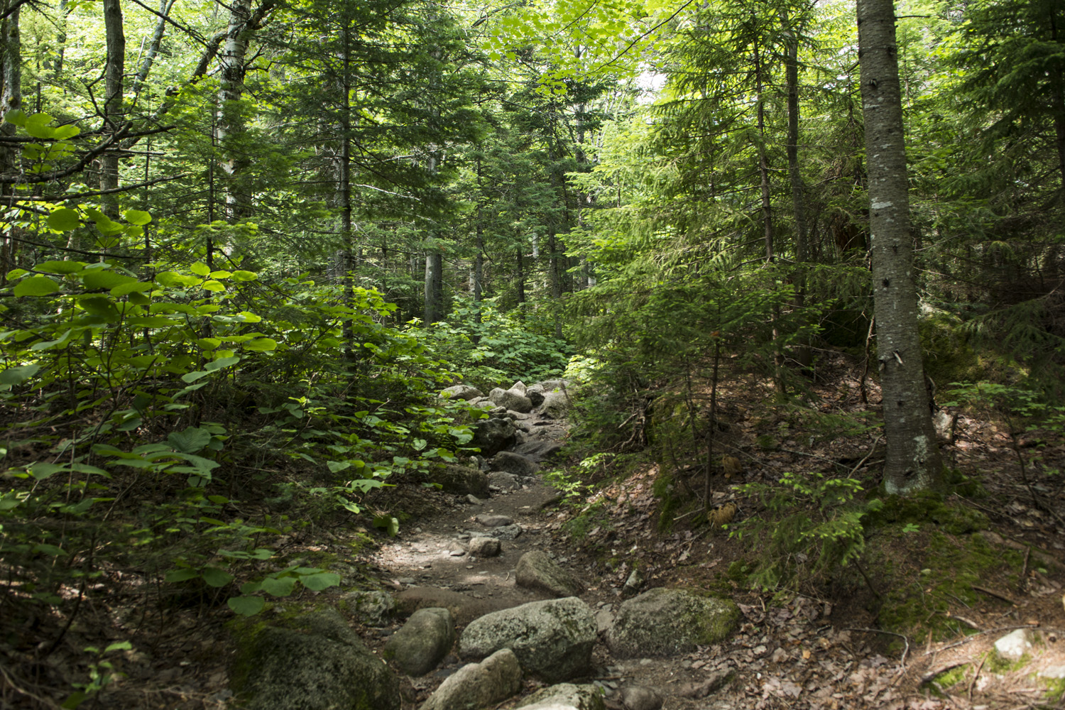
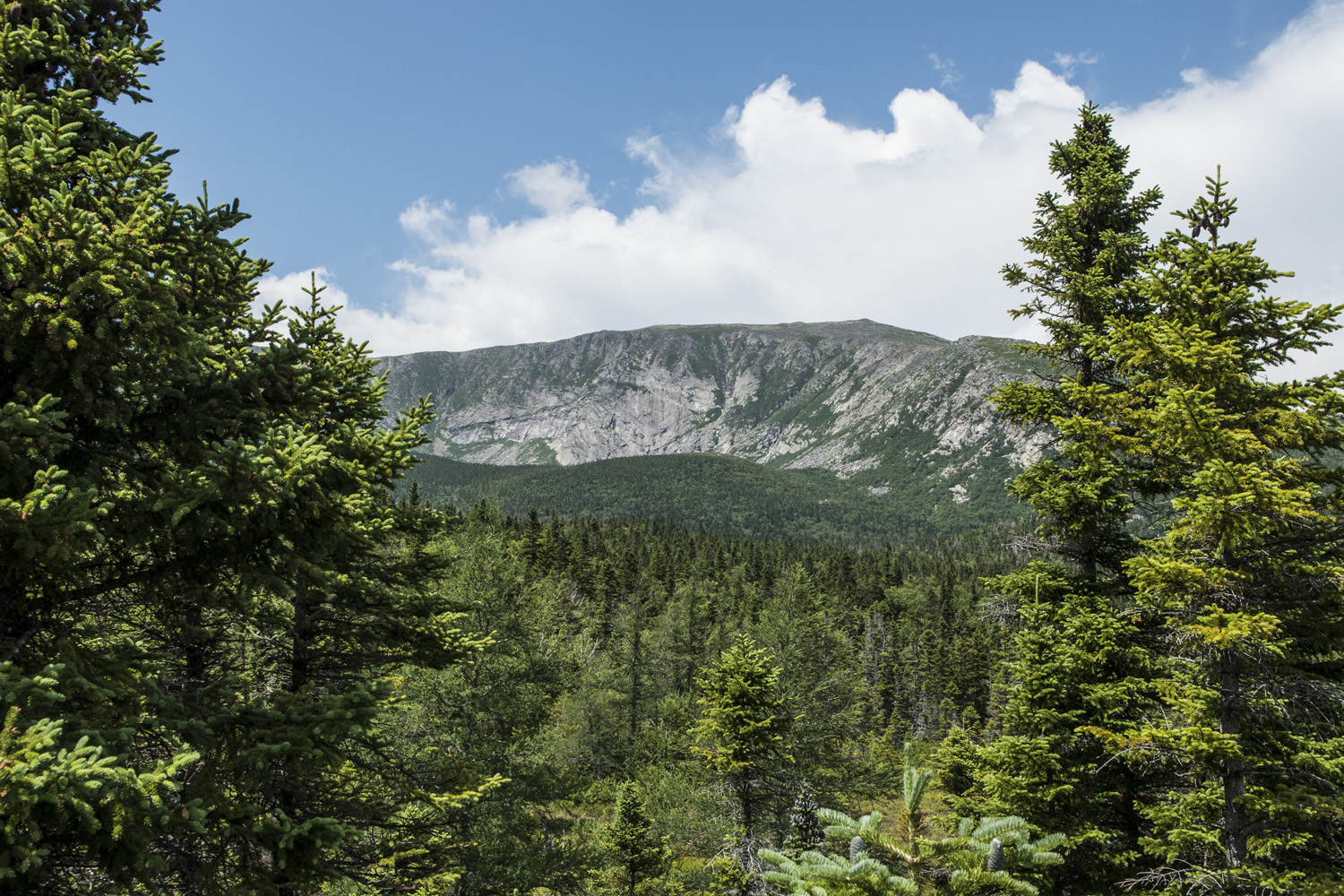
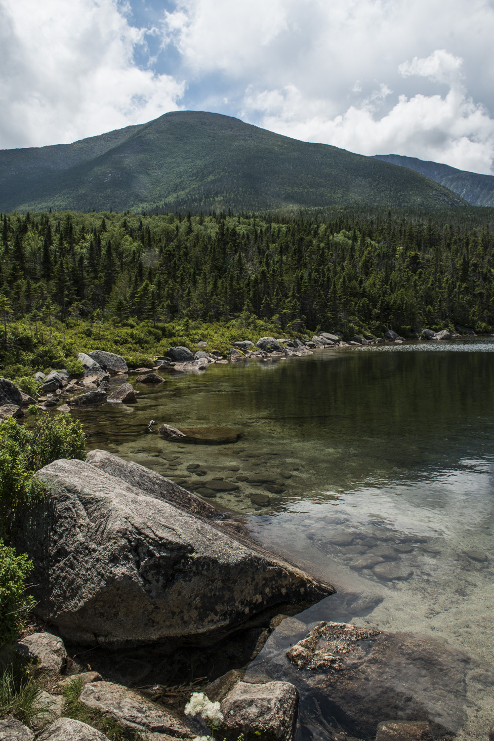
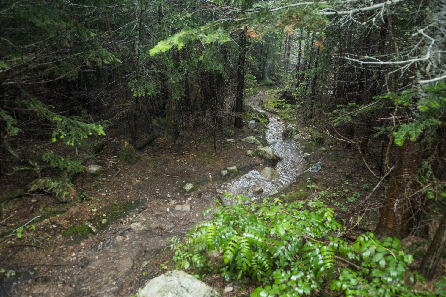
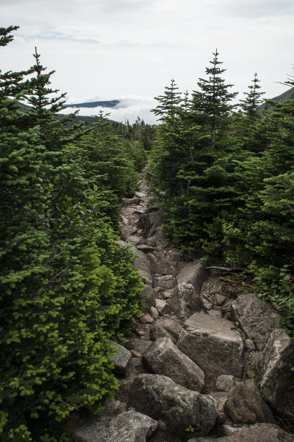
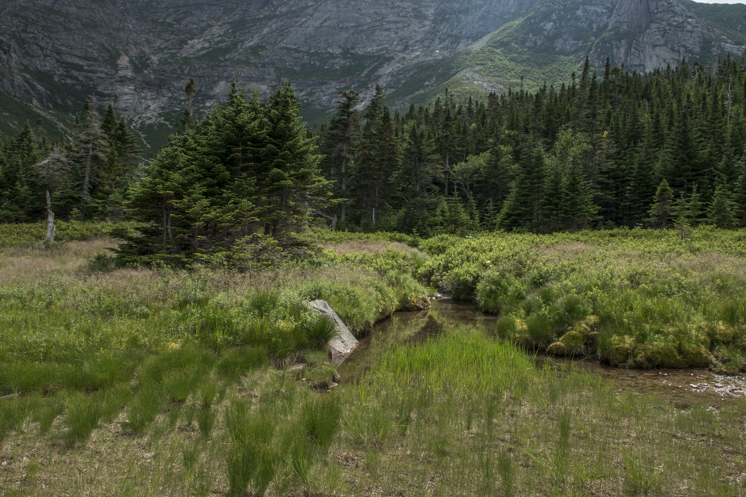
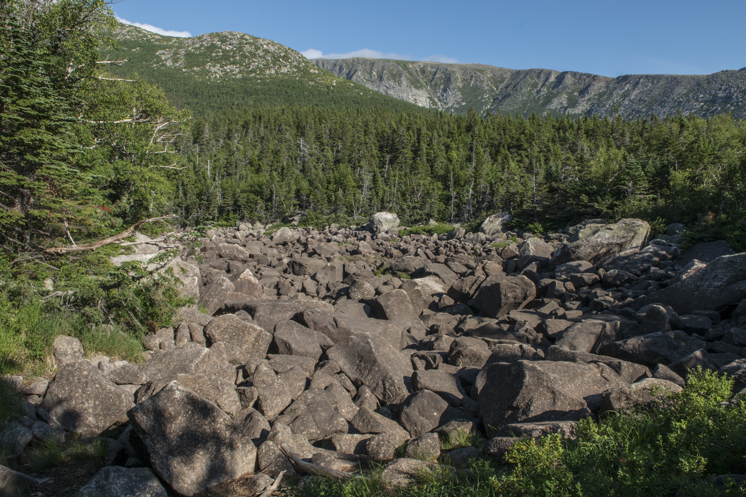
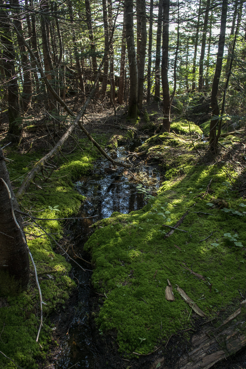
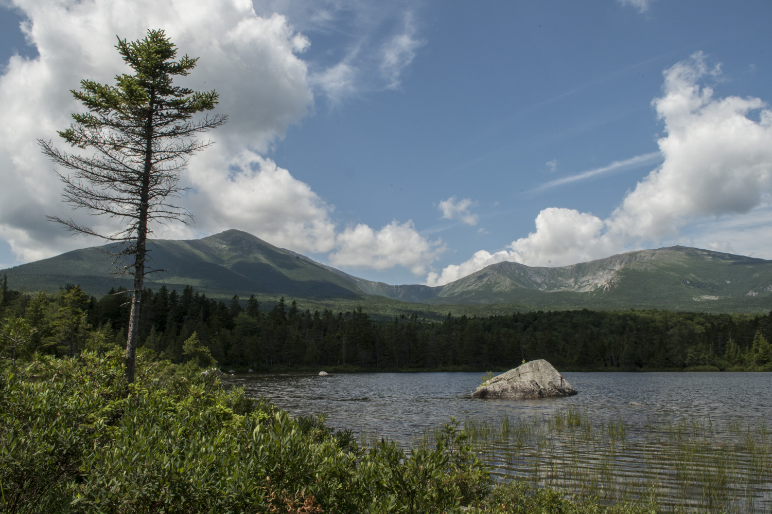
The trail was somewhat wooded and rocky (though not as rocky as a typical Adirondack trail). There are several landmarks along the way that help break up the hike, such as a stream crossing, trail junctions, and passing a few small ponds. I always find it makes the hike go by faster if there are checkpoints you can use to keep track of distance covered and distance left. One of these checkpoints was Lower Basin Pond. From here I could get my first real view of Katahdin since hitting the trail. It can be seen from outside the park, but the thick canopy prevents any views once you get closer to it. And still with the distant thunder.

View of Katahdin from Lower Basin Pond
Just up the trail from from Lower Basin Pond is Dry Pond. As the name would imply, it was indeed dry. It looked like a several acre depression full of rocks. I believe it is seasonally filled with water. After passing another trail junction it was just a few more minutes before reaching the campground. Overall the hike in was pretty easy. Not a huge amount of gain and what little there is is mostly toward the end. From Roaring Brook trail head to Chimney Pond campground is about 3.25 miles and it took me about two hours. I wasn't in a hurry and I made a few stops along the way.

Lean-to #3 at Chimney Pond, home sweet home for two nights
I stopped by the ranger station to check in, but the ranger was out. I decided to find my lean-to and get set up. No sooner had I found my lean-to and it started to rain. It rained so hard that the trail in front of my lean-to turned into a small stream. It really rained hard for a good 10 to 15 minutes. I was hoping it would hold off until I got to my site, I guess someone was listening. While the rain came down, I got set up. The lean-to was big enough for my two man tent with room to fit another one. This was my first time camping in a lean-to. The obvious advantage is that you are out of the elements a little. I put the tent up but didn't need to put the rain fly over the top of it, though I had it with me just in case. There was an outhouse and a community line to hang food from nearby(because bears).
If you plan on staying at Chimney Pond, or anywhere in Baxter State Park, make reservations as soon as possible. I made mine within days of being able to, which was four months ahead of expected arrival. Baxter SP is notorious for being tight with reservations and access to the park. Maine residents get priority and spaces fill quickly. The fact that I was there from Monday to Wednesday helped avoid the more popular weekend. Don't rely on just showing up whenever and hope to get in, you might be disappointed. Secure a reservation if possible. Visit the park's website here to start planning.
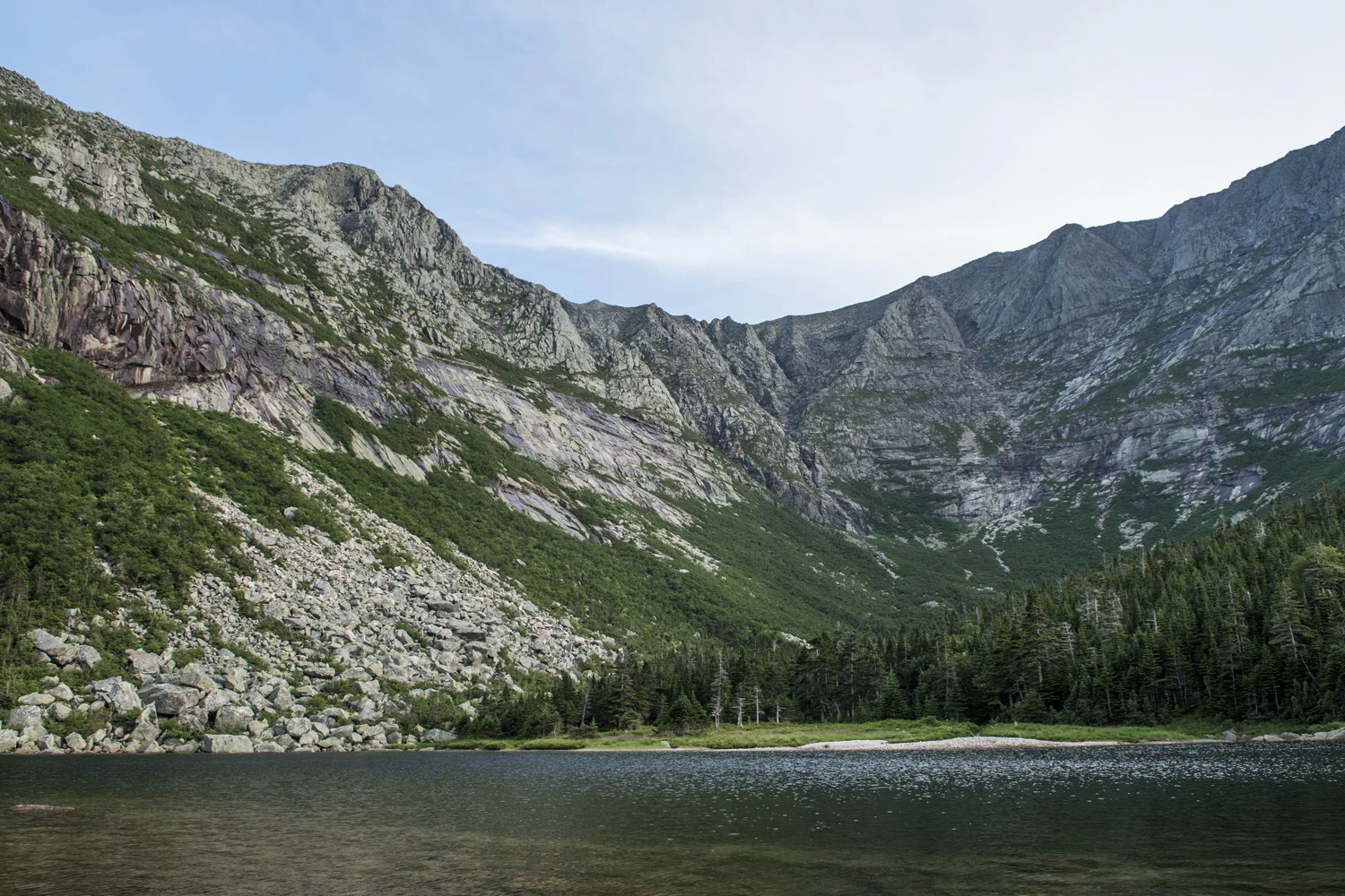
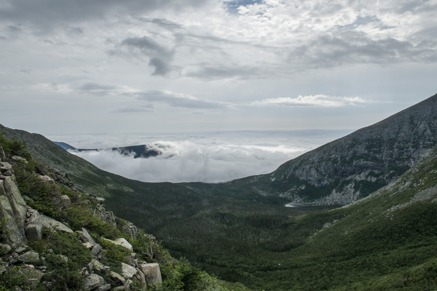
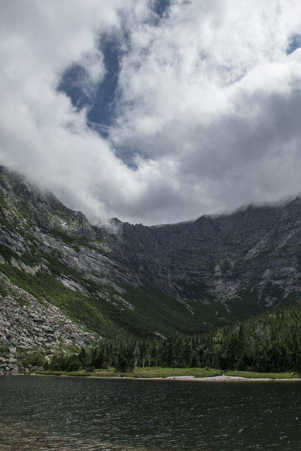
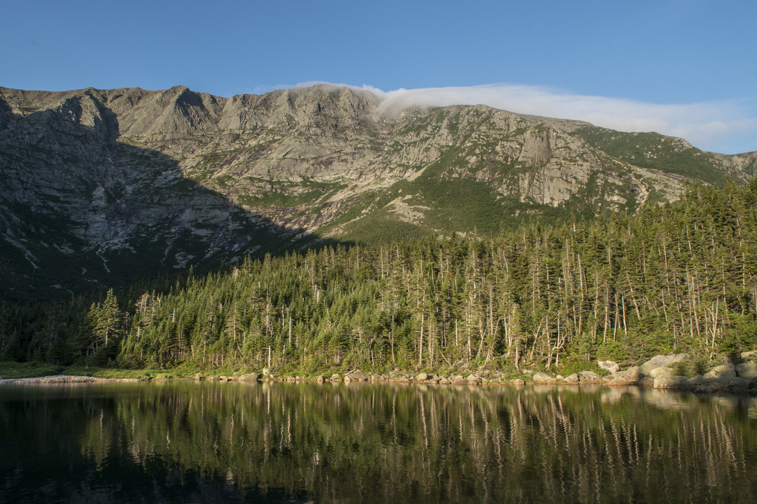
Once I was settled in I stopped in at the ranger station to let them know I was there. The station is just a dozen yards from the campground's namesake, Chimney Pond which is about 3 to 4 acres in size. The whole of Mount Katahdin, from Pamola Peak to Baxter Peak and over to Hamlin Peak, forms a giant horseshoe shape. It sort of looks like a blown out volcano, not unlike Mount St. Helens, except it isn't a volcano. Chimney pond lies in the center of this horseshoe with stunning views of the eastern slopes of Katahdin. You truly feel surrounded by the mountain.
Back at the lean-to I made some dinner and started getting ready for the next morning's summit attempt. I had been iffy about bringing my tripod. It's not heavy as far as tripods go, but it's still extra weight. And the panorama head is just a small piece of diamond plate steel. Yep, I'm bringing a piece of steel plate with me to hike up a mountain. Katahdin is probably the hardest hike I would consider doing and still bring this stuff. Anything harder and I would just hand hold everything, which I have plenty of practice at.
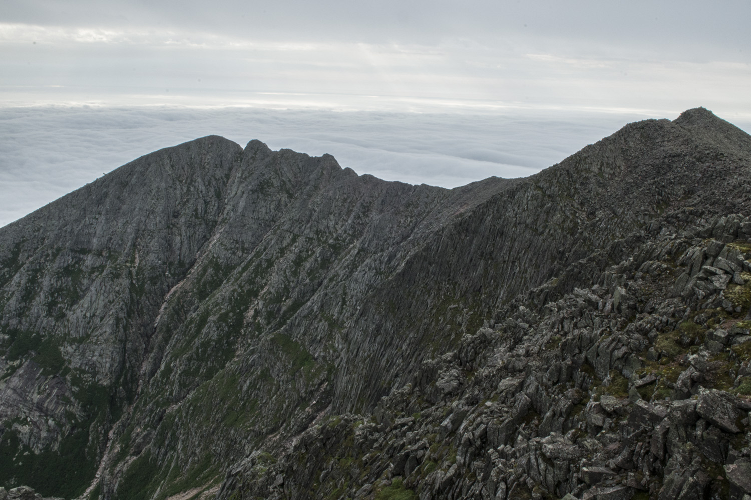
One set back about my summit plan was the closing of the Dudley Trail, which connects Pamola Peak with Chimney Pond. My original plan was to hike a circuit from Chimney Pond up the Saddle Trail to the high point, across the Knife Edge to Pamola Peak, and then down the Dudley Trail back to Chimney Pond. Unfortunately the Dudley Trail was closed due to damage which meant the circuit was not an option and I would be doing a round trip. I missed out on doing the Knife Edge last time and would most likely not be able to do it this time either. As of this writing (April 2018) the Dudley Trail is listed as closed until further notice. Plan accordingly.
As night set in I tried to get some writing done. I still had an article to write for the Fuze about the Nickelback concert I covered (they were actually pretty good). So I was typing away on my phone's notepad. Not as convenient as my desktop computer back home, but it was working. Surrounded by all this nature and I'm still staring at a screen. Such is modern life. Eventually I laid down to sleep so I could get an early start.
SUMMIT DAY

My summit route from Chimney Pond. Short but challenging.
I got up at the wee hour of 3:30 in the morning. I wanted to get going before sunrise, which was at 5:00 a.m., and it usually takes me a while to get my stuff together and eat. Once I put my food stuff away and double checked my gear I threw on my headlamp and hit the trail. I would be taking the Saddle Trail from the campground up to the saddle between Baxter and Hamlin, where it hangs a hard left and heads up to the highpoint, Baxter Peak. That was all I planned on, I would assess other options once I was up there. I was determined to make it this time. Getting a much earlier start from a much closer starting point was a huge advantage. I just wanted to beat any afternoon storms. Compared to my 2013 attempt I already had about a five hour head start.
The first section of trail wasn't too bad. Rockier than the Chimney Pond trail and a little steeper. Where it starts to hit the main slope of the mountain is when it gets interesting. As the big trees start to thin out the brush and shrubs get thicker. And the bugs were coming out as well. I put the head net on for a bit. The steepest section, the slide, is short at only about a quarter mile long but it is almost aggressively steep. Plus it is full of loose rock and poor footing, so take care when climbing it, especially if you're not in front. I was by myself so I didn't have to worry about knocking rocks down on anybody, though I still tried to be careful.
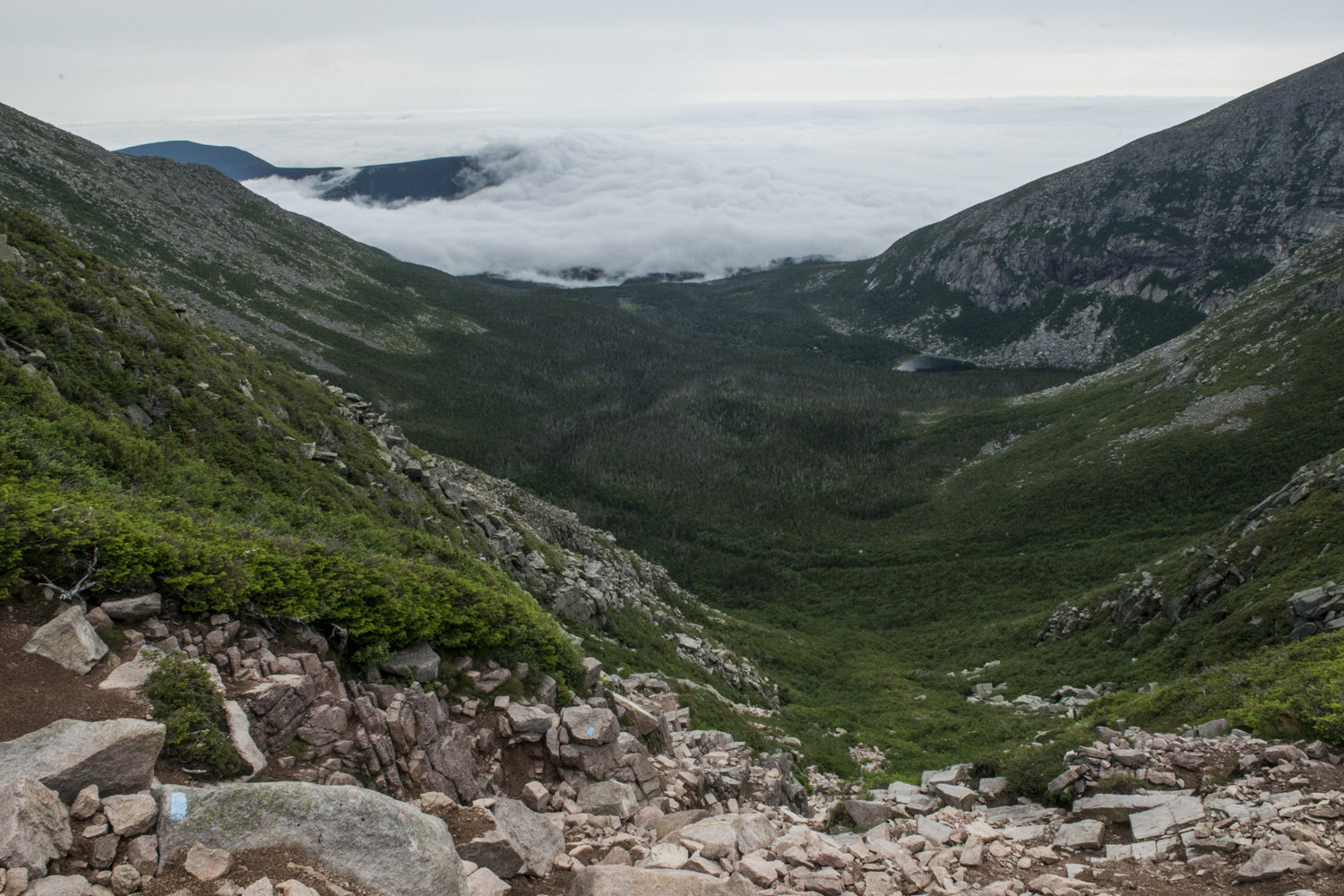
The good thing about the slide section is that it's above tree line and mostly above the shrubs as well as being nice and wide, which gives you options for picking out a route as you go. In fact, the slide is wide enough that it is visible from at least four miles away. If you take the short nature trail from Roaring Brook trail head up to Sandy Stream Pond you can clearly make out the slide section. The slide also offers you you're first real view of the amazing landscape. I addition to the thick overcast sky, the valleys down below were filled in with fog, and I was in the clear layer in between. The campground wasn't fogged in so it was a nice surprise to see that view. It was pretty surreal.

View from the slide on the Saddle Trail, with the overcast sky and fog filled valleys set against the rising sun
Eventually I made it up the slide to the saddle between Baxter and Hamlin. Up until this point I had no views at all of the western skies. Now that I was up on the table land I had sweeping panoramas to the west, and I didn't like what I saw. Black clouds. Dammit. It's times like this when you have to do some risk assessment and make some decisions. To paraphrase Deadpool, let's pro/con this highpointing thing. Pro: I was only about 3/4 of a mile from the summit with much gentler gain to deal with. I could make it fairly quickly. Con: Getting caught in rain sucks. I've never liked being out in the rain, much less on mountain tops. Pro: Unlike last time, I wasn't dealing with the Knife Edge this time so I would have a fairly safe way off the mountain even if it did start raining and storming. Con: I say fairly safe because that slide section was sketchy enough when it was dry, I'd hate to tackle it when it's raining. As I stood there debating I was also watching the clouds. They seemed to be drifting northeast around the mountain instead of east towards it. That was the decider. I was going for it.
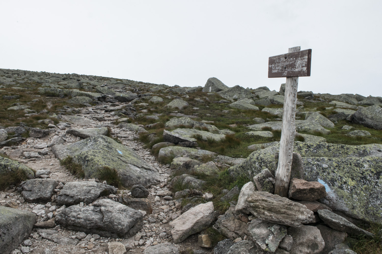
I didn't waste any time. I got my hustle on and boogied up toward the peak. I barely even stopped for pictures. The whole time I kept an eye on those black clouds. They never seemed to get any closer and continued drifting around the mountain. This was good, but I still didn't trust it. I kept motoring up the mountain. This section is broken up into smaller chunks by two trail junctions that act as those checkpoints I like so much. I could eventually see the summit sign 100 yards ahead. Almost there. And those clouds were holding their course.
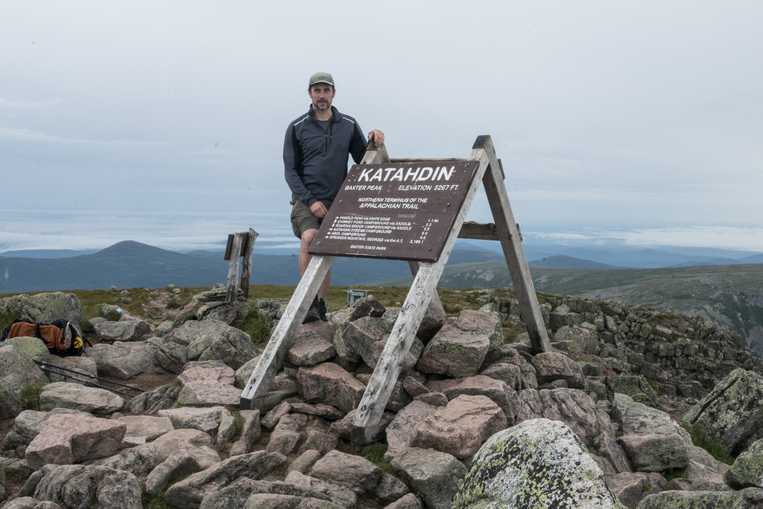
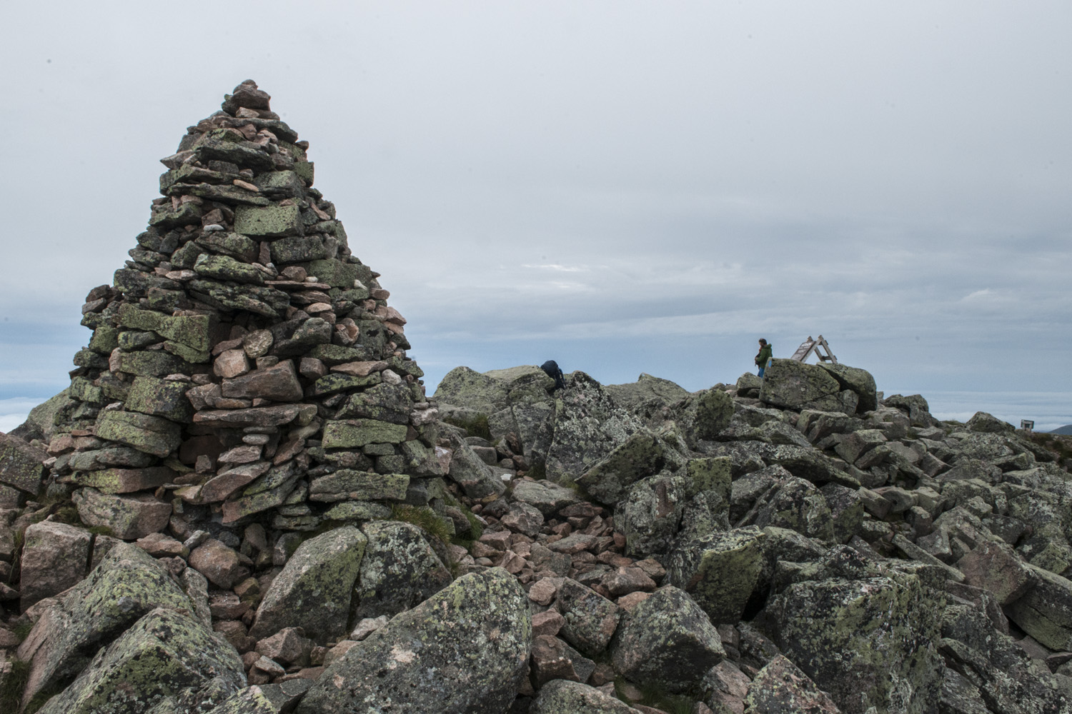
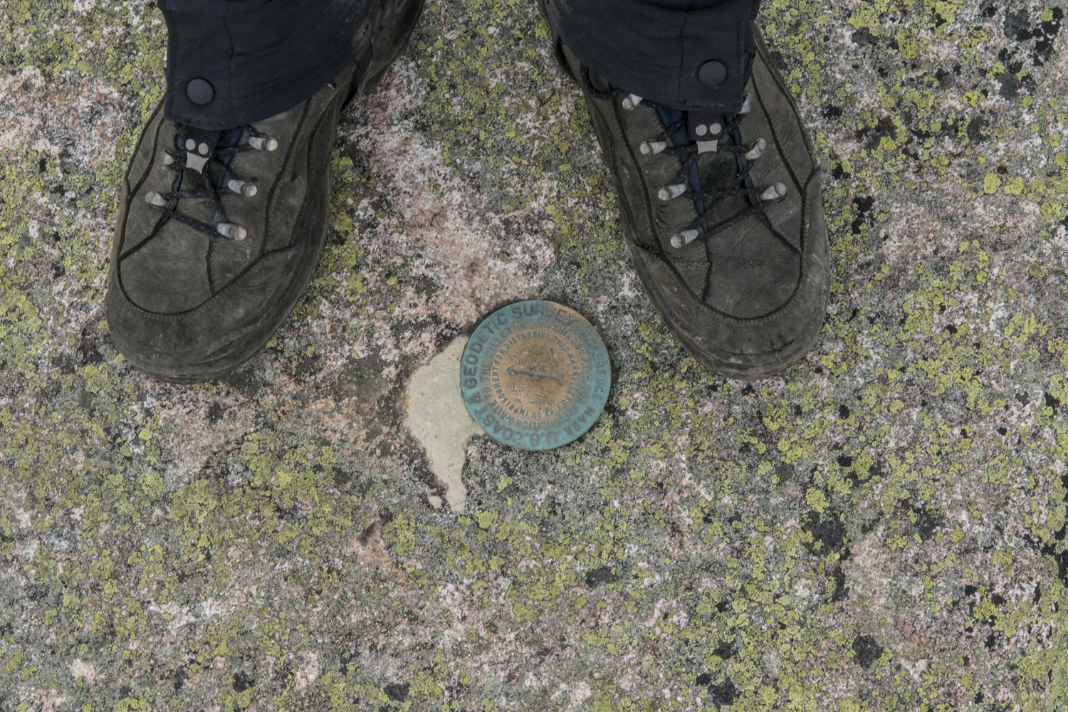
Me with the summit sign on Baxter Peak
Finally made it. I walked up to the sign and breathed a sigh of relief. After worrying about just getting up there all morning, I could now just relax for a bit and take it in. A few yards away was the large summit cairn. In 2013, from Pamola Peak, that cairn seemed tantalizingly close. Almost taunting us to go for it. And now, there I was finally standing next to it. The long wait for redemption was over.
I got to work setting up my camera and tripod to shoot the panorama. The clouds above and fog below made for some really dramatic views and I wanted to capture them before anything changed. Snacks and rest break would have to wait. As I was shooting I noticed another hiker making his way up the western slope on the Hunt Trail from Katahdin Stream trail head. That section of trail also happens to be the final section of the storied Appalachian Trail, which starts in Georgia and terminates right where I was standing. I wondered if he was a north bound through hiker about to take his final steps after a very long journey. As he made it to the summit sign he hugged it like a long lost lover. I think I had my answer... almost.
I struck up a conversation with him. He went by the name "Sniffles". AT hikers always take on nicknames which become their functioning name while they're on the trail. I found out that Sniffles had started his hike on the New York section of the AT. So a section hiker, not a through hiker. But still, at around 800 miles that's a hell of a section. I took his picture as part of the panorama, viewable at the top of this post. He told me of a couple other guys that were about two hours behind him. I was tempted to wait for them to take their pics as well, but I just didn't trust the weather and wanted to start down sooner rather than later. Sniffles seemed like a cool guy. We chatted for a bit and then he started making his way back toward Katahdin Stream. It was an experience to actually witness an AT hiker takes his final steps on one the most famous trails in the world.
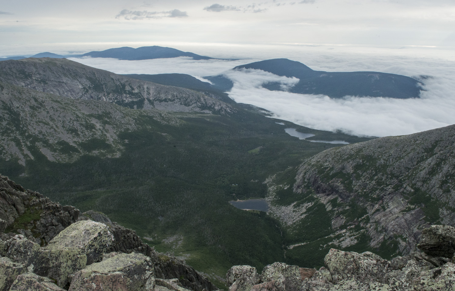
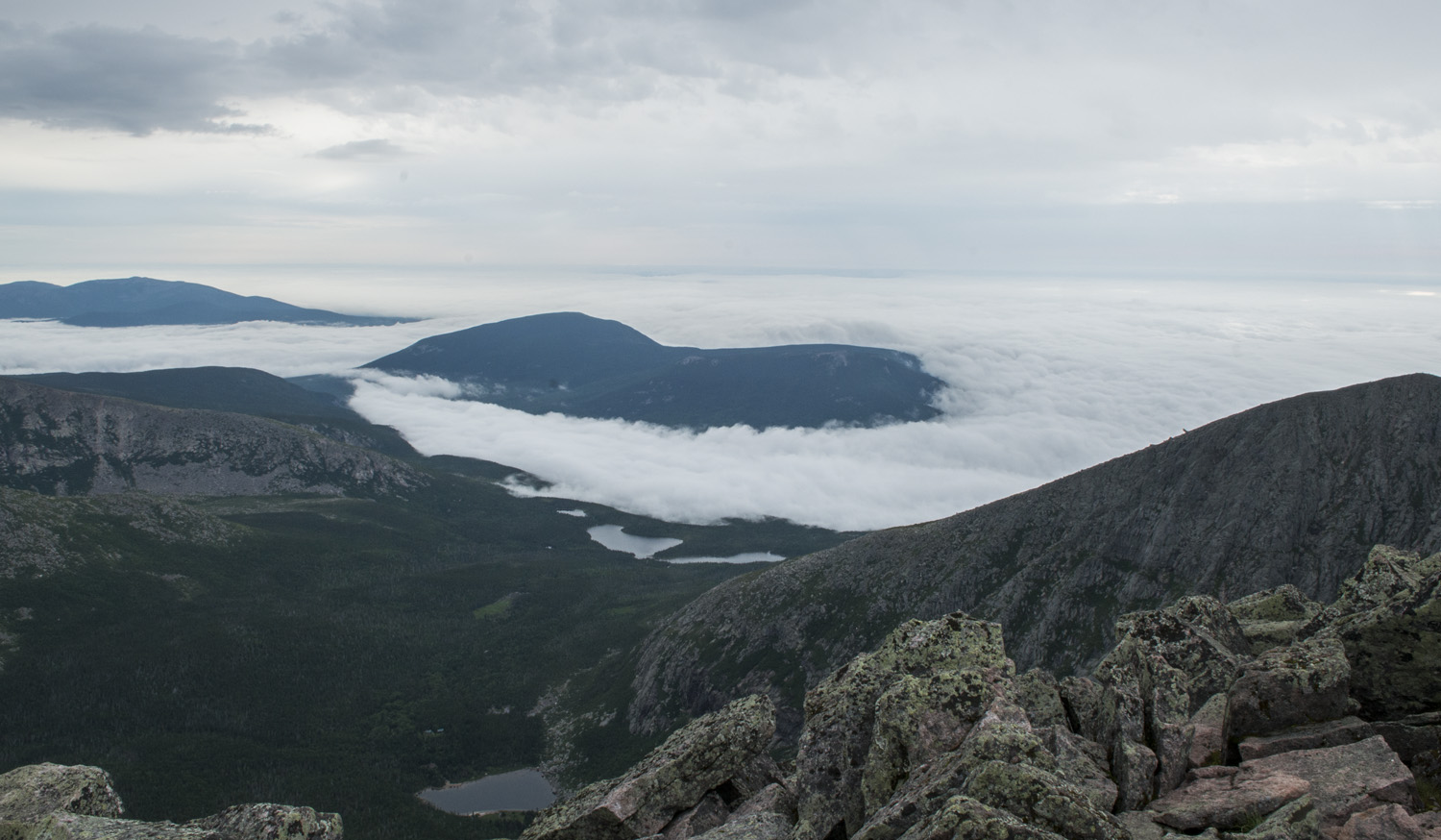
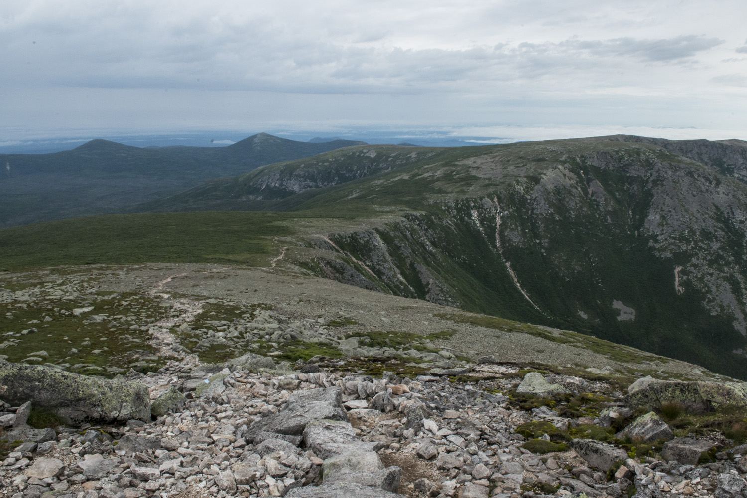
View from the summit. Chimney Pond is in the bottom middle, the Basin Ponds a little farther back, and then the fog filled lowlands.
After I took a rest and had something to eat I packed up my gear and got ready to head back down. Had it been a nice day I might have attempted to go out and back across the Knife Edge, but with my paranoia about the weather I quickly took that off the table as an option. The one feature I really wanted to do, other than the summit itself, was the Knife Edge but it just never quite seems to happen. perhaps I'll make it back someday to give it another go. Down I went back to camp.
The slide section was just as sketchy on the way down as it was on the way up. It's steep enough that you have to really control your speed and take measured steps. You can't just go on auto pilot. I met my neighbor from the campground as he was on his way up. The slide feels about four times longer than it actually is. One of my checkpoints was a stream crossing that seemed to mark the bottom of the slide, where the slope really tapered off. Once I was back in the trees it was relatively smooth sailing back to camp. It never did rain, thankfully.

Sun shining through as clouds roll over the summit. From Chimney Pond.
When I got back to my lean-to I checked the time. It was only 10:00 a.m., not even lunch time yet. I still had one more night in the lean-to and since my objective was complete I had the rest of the day to just hang out at camp and relax. I took a midday siesta, did some more writing, went rock hopping around the shore of Chimney Pond, talked with neighbors. It was just a nice quiet day in the woods.
The weather finally broke a little and became partly cloudy. Nature put on quite a show as clouds started rolling the edge of the mountain, obscuring the view of the summit, with occasional rays of sun poking through. I just sat on the shore of Chimney Pond and watched the spectacle, which was changing by the second. These are the moments us outdoorsy people live for.
It was a good thing I summited when I did. Had I done it later in the day the summit would've been covered in clouds and I wouldn't have seen a thing. It was an awesome show from the campground, but it would've been a white out up top.
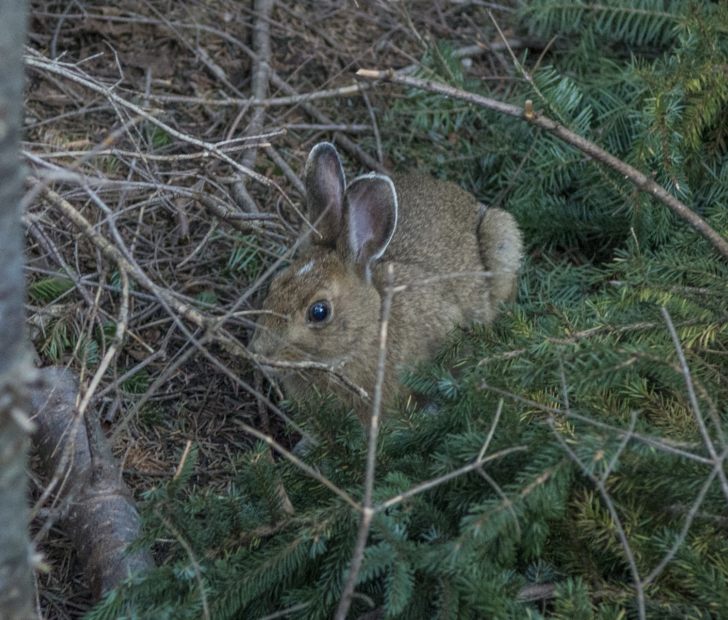
My only encounter with the wildlife was with the small furries that can be a nuisance. I had seen rabbits, squirrels, and chipmunks within yards of my lean-to at various times. The last thing you want to do is feed them or encourage them in anyway, so I would pick up small stones and throw them near the critters to try and scare them away. They didn't scare easy. As I was trying to scare this one chipmunk, I accidentally got a little too close with my throw and beaned him right in the head. He fell off the back side of the rock he was standing on and all I could see were his four little feet up in the air. Crap! I didn't mean to actually hit him. Now I felt awful. After a minute though, he started to twitch. Suddenly he righted himself and scurried off. Conscience clear.
As night fell the sky cleared up and the stars came out. I got talking with some other people from the campground about space, music, life, that sort of thing. It was a nice end to a rewarding day. The next morning I packed up my lean-to and made my way back toward Roaring Brook.
My 2013 visit taught me a lot of lessons. I wasn't as prepared back then. For one I didn't even have any rain gear with me then. When it started raining I had to borrow a trash bag and make a rain poncho out of it. This time I had a rain coat, rain pants, pack cover, the whole deal. I also wasn't quite prepared for the disappointment of not getting a highpoint. I just assumed I'd get it. It doesn't always work out that way. Now I always have it in my head that just because I try for a highpoint doesn't mean I'll get it. Luckily since then I've gotten Granite Peak and Borah Peak on my first tries, but I also planned for success as much as I could ahead of time. All lessons learned on Katahdin.


Other posts in this series:
Great Basin National Park, Nevada. An Unexpected Journey.
White Butte, Highpoint of North Dakota. Really? More Goats?
Mount Katahdin, Highpoint of Maine. If At First you Don't Succeed...
Hawkeye Point, Highpoint of Iowa. So... Much... Corn...
Granite Peak, Highpoint of Montana. I Have Seen The Top Of The Mountain, And It Is Good.
Mount Borah, Highpoint of Idaho. The Great American Eclipse Of 2017.
Tri-Point Of Iowa, Nebraska, And South Dakota. Hot. Damn Hot. Real Hot.
Sassafras Mountain, Highpoint of South Carolina. Please excuse our mess.
Ebright Azimuth, Highpoint of Delaware. Rock bands and space shuttles.
Charles Mound, Highpoint of Illinois. A farmland stroll.
Tri-point of NC, TN, and VA. My car meets its match.
Mount Rogers, Highpoint of Virginia. OH MY GOD!!! LOOK AT ALL THE FUZZY PONIES!!!
Guadalupe Peak, Highpoint of Texas. Birth of an obsession. And big freaking bugs.